Forum Replies Created

Viewing 30 posts - 1 through 30 (of 2,802 total)
  • KirtH
    Lakeville
    Posts: 4063
    #1680374

    <div class=”d4p-bbt-quote-title”>KirtH wrote:</div>
    Nope it’s real time mapping on the screen appearing right before your eyes. Read my notes above

    Any knowledge of when the gen 2 touch update will be out?

    Nope check with Lowrance but they probably won’t say if it and when

    KirtH
    Lakeville
    Posts: 4063
    #1680364

    Nope it’s real time mapping on the screen appearing right before your eyes. Read my notes above

    KirtH
    Lakeville
    Posts: 4063
    #1635802

    Works for me.

    KirtH
    Lakeville
    Posts: 4063
    #1635432

    I use Bob, he works hard at keeping his customers happy at great prices. Worth a call
    Phone: 517-627-8080

    Toll-free: 800-339-1235

    Fax: 517-627-3355

    Email: [email protected]

    Address:
    Worldwide Marine Underwriters
    100 W. Saginaw Hwy. Ste. C
    Grand Ledge, MI 48837

    Staff:
    Bob Luellen – Marine underwriter and producer, and a 20-year insurance veteran with over 30 years of experience in the marine industry. He is the founder of Worldwide Marine Underwriters.

    Diana Weber – Office manager, marine account manager, and certified insurance service representative (CISR)

    Bill Stehouwer – Marine underwriter with over 25 years in the marine industry

    Laurie Reeves – Customer service representative

    Hanna Weber – Customer service representative

    KirtH
    Lakeville
    Posts: 4063
    #1631227

    Has anyone started using navionics sonar charts? I’m a little stupid about it. Can I use the sonar charts feature directly on my Dragonfly 4 or is it only something that you can use if you are integrating an iPhone or ipad with your sonar?
    You have to connect your Dragonfly to your mobile device via wi fi and the Sonar Chart Live will then be shown on your mobile device. This new data is then uploaded to Navionics to be processed and incorporated into the SonarChart layer. You then do an update to your mobile device mapping in the app or your Navionics + mapping card.

    What if I don’t want to share my sonar readings, or am I volunteering to do so by using the software?

    Yes.

    KirtH
    Lakeville
    Posts: 4063
    #1628187

    Navionics has the WebApp you can look at all their Lake Maps on so if you know the lakes well enough you can check it out. These represent whats on the Map Cards such Navionics+ or Navionics Updates.
    https://webapp.navionics.com/?lang=en#@6&key=%7B%7CkoGfinxP

    He must not be fishing the lakes your one.

    KirtH
    Lakeville
    Posts: 4063
    #1626839

    Simms or Guidewear

    KirtH
    Lakeville
    Posts: 4063
    #1626344

    Like mentioned get the Navionics+ card. The card comes preloaded with Nautical Charts or base map, you download the High Def SoanrChart layer to the card of the area or areas you fish. It comes with a year of updates so you can plug it into your computer and refresh the card so your card doesnt become outdated.

    KirtH
    Lakeville
    Posts: 4063
    #1626166

    Price reduced 1000.00

    KirtH
    Lakeville
    Posts: 4063
    #1625870

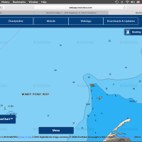
    Get the Navionics Mobile app US and Canada for 14.99. You can preview the mapping online at the WebApp
    http://webapp.navionics.com/?lang=en#@6&key=%7B%7CkoGfinxP

    Be sure to click on the icon on the lower left for the SOnarChart layer of the lakes of interest.

    If you are traveling out of cell coverage you can download the lake to your phone (very little memory is used) then put your phone in airplane mode turn on your app and the internal GPS will track you.

    My Youtube channel has some how to videos https://www.youtube.com/channel/UCwzHyehLnTQH6Y3uDgVz72g

    KirtH
    Lakeville
    Posts: 4063
    #1622722

    Not real computer savy, is this download easy to do? Also how difficult to do updates? Thanks

    KirtH
    Lakeville
    Posts: 4063
    #1622429

    Get Navionics+ Preloaded it covers all of US and Canada on one one card. It comes preloaded with the Gold or Premium data then you download the high def SonarChart layer to the card of the areas that you fish. You can preview the mapping online on the web app. Zoom in on the areas of interest and click on the icon on the lower left for the SonarCHart High Def view
    https://webapp.navionics.com/?lang=en#@0&key=actiAvzweO

    KirtH
    Lakeville
    Posts: 4063
    #1621669

    I did some mapping for Navionics last fall, this is far as I got before it got to late in the day. If you go to the web app you can look at, I have more data to upload this spring. Its also available on the Mobile App
    https://webapp.navionics.com/?lang=en#@12&key=%7DumtGtxrtP

    Attachments:
    1. Screen-Shot-2016-05-27-at-5.08.50-PM.png

    KirtH
    Lakeville
    Posts: 4063
    #1620100

    Contact Motorguide there was a software update that addressed this

    KirtH
    Lakeville
    Posts: 4063
    #1619614

    SOLD!

    KirtH
    Lakeville
    Posts: 4063
    #1619586

    70.00 each or 130.00 for the pair

    KirtH
    Lakeville
    Posts: 4063
    #1619012

    Are the rods still available? What are the model numbers?

    Thanks ….

    TIC76MM yes they are. You are the first in line so you get first dibs

    KirtH
    Lakeville
    Posts: 4063
    #1618732

    How hold are these Kirt?

    About 3 years old if I recall
    They are very clean

    KirtH
    Lakeville
    Posts: 4063
    #1614642

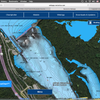
    Stoddard, some the backwater may not be mapped just due to accessibility and continuing changes. Similar to Pool 3 up here, I did some mapping work as did BK of the backwater areas up here.

    If you can run a Hotmaps Platinum its a great river chip with Satellite imagery, but you need a HDS or an upper end Hummingbird

    Attachments:
    1. Screen-Shot-2016-04-20-at-5.45.41-AM.png

    2. Screen-Shot-2016-04-20-at-5.45.00-AM.png

    3. Screen-Shot-2016-04-20-at-5.44.55-AM.png

    KirtH
    Lakeville
    Posts: 4063
    #1614640

    What sonar do you have?

    KirtH
    Lakeville
    Posts: 4063
    #1614591

    Shoot me a call or message if you have more questions

    KirtH
    Lakeville
    Posts: 4063
    #1614588

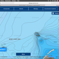
    Example shown

    Attachments:
    1. Screen-Shot-2016-04-19-at-9.01.32-PM.png

    2. Screen-Shot-2016-04-19-at-9.01.41-PM.png

    KirtH
    Lakeville
    Posts: 4063
    #1614587

    Did you click on the icon on the lower left for the SonarChart layer, much more detail than the Gold or Premium layer.

    Give me an area and I will look at it.

    KirtH
    Lakeville
    Posts: 4063
    #1614572

    I have the Xi5, one of the first ones out it has worked great very happy with mine, a couple software updates initially and all is good

    KirtH
    Lakeville
    Posts: 4063
    #1614562

    Go with Navionics+ it covers all of US and Canada one card. It comes preloaded with Gold or Premium mapping, you then download the High Def SonarCharet layer for the areas that you fish such as MN/Dakotas/Canada. You can preview the mapping online on the web app https://webapp.navionics.com/?lang=en#@6&key=orbpGbpzwP

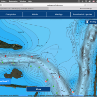
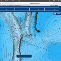
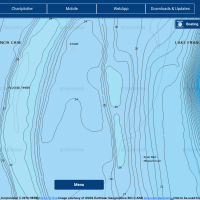
    After you zoom in on the lake of interest, click on the icon on the lower left for the SonarChart view. I attached some examples of LOTW

    Attachments:
    1. Screen-Shot-2016-04-19-at-7.26.00-PM.png

    2. Screen-Shot-2016-04-19-at-7.25.56-PM.png

    KirtH
    Lakeville
    Posts: 4063
    #1614482

    Bob what sonar do you have? This will help me with a rec.

    KirtH
    Lakeville
    Posts: 4063
    #1614096

    If you go to Navionics.com click on the web app, here you can actually see the mapping offered by Navionics vs guessing what it looks like. If you fish the upper midwest Hotmaps Platinum with SonarChart if you venture outside he midwest get the Navionics+ it covers all of US and Canada on one card with Nautical Chart or the same data that came on Premium you download the High Def SoanrChart data for the area or areas you fish.

    When you go to the WebApp click on the icon on the lower left corner to view the high def SonarChart layer.

    Navionics also offers a year of unlimited updates with the card purchase so your card never goes out of date fro the first year, this allows you to refresh your card with the most current data as Navionics does mapping updates. You can resubscribe fro another year at 50% off of initial purchase price.

    Missouri river is 100% better on Navioncs vs Lowrance Insight.

    Attachments:
    1. Screen-Shot-2016-04-18-at-9.08.16-AM.png

    KirtH
    Lakeville
    Posts: 4063
    #1613557

    Sold to Christopher

Viewing 30 posts - 1 through 30 (of 2,802 total)