Where are you located?
Forum Replies Created
-
May 23, 2019 at 11:23 pm #1858579
As far as I know everything by Wabasha will be closed. Camp LaCupolis may be open. You would have to contact them. The Lake City marina will be open as a pay ramp. Hok si la should stay open. Roschen may stay open, but some of the parking will be under water. By Red Wing Colvill and the back channel are closed. Bay Point and Everts should be open barring changes from rain tonight.
February 9, 2019 at 8:31 am #1833923Fisheries biologist for the last 13 years. From managing fish, people, and policies to surveying and surgery in good weather and really bad. There is always something interesting to work on.
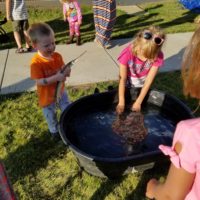
August 1, 2018 at 8:43 pm #1789007I was giving a fish presentation on Monday, and my 2 year old decided he needed to take charge of the presentation at the small tank.
August 4, 2016 at 8:54 am #1632329Just as a note of caution. I have often seen the bottom teeth of northern, particularly big ones, cut through the upper jaw and get people in the thumb when trying to hold the fishes mouth shut like stillakid2 recommended.
June 16, 2016 at 8:36 pm #1624922My guess is you did it right, but the basic software running the online converter only keeps the coordinate fields. I will try to play around with the DNRGPS software and see if I can get that to preserve names.
June 16, 2016 at 1:41 pm #1624859Download the Shapefile option from here.
https://gisdata.mn.gov/dataset/loc-water-access-sites
It is a zipped file. Inside there are 5 files you need to upload. They have the extensions:
.prj
.sbn
.sbx
.shp
.shxWhen you are done you will have all 5 files loaded into the “Upload your data files” box in the upper left hand corner.
Click submit query and the files will load, and the points will display on a map.
Target Vector Format choose GPX – GPS Exchange format
Select “WGS 84” for output coordinate system and click convert now.
Click download results and wait for the 30 second ad.
Choose where to save the file. It should be a folder with a GPX file inside of it.
If you have a bunch of files to convert the MN DNR produced a free gps data converter called DNRGPS that is available here.
ftp://ftp.dnr.state.mn.us/pub/gisftp/DNRGPS/dnrgps.zipdocumentation is here
http://www.dnr.state.mn.us/mis/gis/DNRGPS/DNRGPS.htmlJune 16, 2016 at 8:08 am #1624783I used the free converter here.
http://converter.mygeodata.eu/#top
Just as a heads up all DNR Data is in UTMs instead of Lat Long so unless you specify a Lat Long or at least non UTM output you get scrambled results. I haven’t had a chance to check the file but this should work.
Apparently a GPX file won’t attach, but this site should work. You have to add all of the shapefile components by browsing to each one separately in the upload stage before you do the conversion.
Output is likely best as WGS 84
May 6, 2015 at 7:41 am #1541571Was the truck a GMC? In general I love GM vehicles but we have 3 new ones, 2014s I think, at work and I have a coworker who has a newer one and all of them seem to blow the fuse for the left side trailer light very easily. We think we tracked the cause to a work trailer, but never had the issue with any of our older GMs on the same trailers.
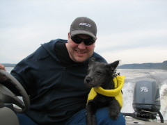
July 3, 2014 at 12:59 pm #1433225He jumped in once while casting for pike, but mostly he wants to help drive.
May 26, 2014 at 5:40 pm #1412316This is a fairly good site, and they have a mobile app though I have never used that.
May 22, 2014 at 8:35 pm #1389743Technically Carp are part of the Cyprinidae (Minnow) Family while Smallmouth, Bigmouth, and Black Buffalo are all in the Catostomidae (Sucker) Family.
There are therefore lots of native (minnows) to choose from.
March 14, 2014 at 5:14 am #1395945Quote:
There is likely a small increase in hooking mortality during this period due to these additional stressors, BUT if the water is still cool it would probably be difficult to detect even if we focused a study on hooking mortality during this specific period of time. Also as you look at the attached figure it is important to recognize that the highest angling pressure and harvest on Pool 4 occurs during late May and June so the dramatic increase in pounds of walleye mortality is partially driven by increasing temperatures and partially by a much larger number of fish being handled.
Seems like the emphasis is on SMALL, and there are many things besides dying from hooking mortality that could disrupt a successful spawn.
February 11, 2014 at 6:46 am #1387724Here are links to the latest fish consumption guidelines for rivers in MN for the general public and Women of childbearing years and children etc.
Women who are or may become pregnant and children under age 15
January 24, 2014 at 10:40 am #1382631D-Rock took care of me hopefully ready to go again this weekend.
December 20, 2013 at 1:47 pm #1373112Stop at a salvage yard. I have purchased a number of fobs for my last few pickups and they often cost less than $5.00 each. There are usually sets of numbers on the fobs and a quick internet search will tell you which numbers are compatible with your year make and model. Then follow the online instructions to pair the fob to your vehicle.
Good Luck!April 2, 2013 at 2:44 pm #1158434You don’t need a tag to fish for sturgeon during the catch and release season or the harvest season as long as you are not harvesting a fish. The only closed season when you can’t fish catch and release with a fishing license and no tag in 2013 is May 16th through June 30th.

