What will Lake Pepin look like?

  • Brian Klawitter
    Keymaster
    Minnesota/Wisconsin Mississippi River
    Posts: 59992
    #1761894

    Here they are and the info for the next Public meeting.
    It’s your lake.

    In full disclosure, I don’t fish down this way. I have been out with others fishing (walleyes) in this area 3, 4 times over the last 15 years. I have frequented the area for sightseeing trips. In other words…I have zero skin in the game with the exception that I care.

    The second public meeting for the lake restoration project is Wednesday, April 4, 2018, 5-7 PM, at the St. James Hotel, Red Wing. LPLA wants to maximize public engagement and influence. To do so, they are giving their followers information that will prepare them for this critical meeting. You’ll find it here: http://www.lakepepinlegacyalliance.org/second-public-meeting-information-guide/

    Attachments:
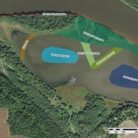
    1. Draft-1.jpg

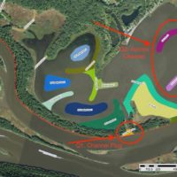
    2. Wacouta-Bay.jpg

    3. Draft-2-Katrina-Blocked.jpg

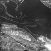
    4. 1938.jpg

    Brian Klawitter
    Keymaster
    Minnesota/Wisconsin Mississippi River
    Posts: 59992
    #1761917

    I’m going to ramble of for a few moments. Follow along if you like.
    Up front I’ll say I’m not in favor of closing off Catherine Pass (Katrina). Not because it’s a fishing hot spot, that’s a bit short sighted but because it’s a spawning area. More on that later.

    10,000 years ago most of this area was under water being carved out by the rushing water of the glaciers melting. Barn Bluff and Memorial Parks were islands. The city of Red Wing was covered with water as was all the other cities inside the river valley.
    As the water receded, the Chippewa River brought it’s sand into the Mississippi causing it to back up creating the Fabiled Lake Pepin with all of it’s villages and cities springing up over the last couple hundred years.

    What would have happened if the folks back then formed an alliance to keep the Mississippi clear of the Chippewa sand? We would have a river all the way down to the Gulf. But we still would have sediments coming from upstream and changing the river each year.

    Fast forward. We have villages and homeowners all around the lake that we’ve all come to know and love. If they aren’t on the main channel, they’re filling in with sediments. So much so that boats can’t get to launch ramps or homeowners docks. This would not make me happy. Really, here’s this lake that I live on and can’t get my fishing boat much less a pleasure craft to my dock.

    What to do?
    Create an alliance and pay someone to run it along with researching how to fix the filling in of the homeowners bay. With all the research going on about the head of Lake Pepin filling in over the next 100 years creating a swamp, it seems that (at least in this case) what’s good for the affected cities and homeowners is good for Lake Pepin. This is assuming we should slow Mother Nature down.

    The Corp of Engineers
    The Corp of Engineers won’t dredge bays because it’s not IN the river channel. The Corp can only spend our money to keep the commercial traffic channel to 9 feet.

    Except.
    Except if it aids them in placing river sand. If a person takes a look at all the Corp projects in the last few years, they all revolve around placing river sand. Now this isn’t inherently bad.

    The river including Lake Pepin is for all. That includes kayaks up to barge traffic and yes, even the fishermans headache, pleasure craft.

    The WI DNR
    Sometime, I need to sit down with one of these guys and have them explain to my why they want to close off every back channel run they can get their mitts on. Most biologist that I talk with want more cuts to back channels or lakes. They benefit a good number of fish species and bird species as well. It seems to me, if cutting off sedimentation is your only goal and blinders are put on for spawning areas and recruitment in general, closing off these areas would be the answer.

    That’s a question each one of us is going to have to answer for ourselves.

    One of the powers that be changed the name of Draft #1 which closed off Katrina, to Draft #2 that keeps it open. I do believe the Corp is open to going either way depending on public input.

    One thing that I find ironic is that while we are chattering about Draft #1 and #2 is that no one has an issue with Draft #3…what the Lake Pepin Legacy Alliance was created for.

    It’s your lake people. By not showing up for the meeting you are making a statement.

    All the above is in my humble opinion.

    buckybadger
    Upper Midwest
    Posts: 8175
    #1761961

    I’m so far from being “informed” on this topic that I probably shouldn’t share my comments, but I will anyways waytogo

    I agree completely that the Corps is not in-place to look out for fish, birds, wildlife, etc. They are paid to maintain a 9 foot navigable channel at all costs. More and more of these “island projects” that will supposedly aid in the sedimentation issues seem to smell a bit funny. To me, the only way to begin dealing with sedimentation is to go to Southern MN farmers along the Minnesota, Miss. and their tributaries, along with the Western WI farmers along the Chippewa. These “island projects” and “closing off cuts” are just creating more options to dump excessively nutrient rich sediment that nobody wants.

    Pool 4 has long been seen as a resource that will never be vulnerable and can handle a lot. In my opinion, “Times are a Changin”

    Brian Klawitter
    Keymaster
    Minnesota/Wisconsin Mississippi River
    Posts: 59992
    #1761972

    Clarification.

    The Corps is only allowed to dredge (or do anything) where we have an authorization from Congress. Dredging the channel for barge traffic is one.

    Placing that sand has to be the “least expensive” and “environmentally acceptable” option. Notice that is “acceptable” and not “preferred”.

    To place sand for the good of the environment, they need to do that under a different authority, such as “Section 204” as is the case here.

    Brian Klawitter
    Keymaster
    Minnesota/Wisconsin Mississippi River
    Posts: 59992
    #1762967

    Critical Questions for Public Input

    1. Should this channel plug be installed? “CP Channel Plug” in Catherine Pass/Bay City Area.

    Description: This feature would completely cut off flow from Wisconsin Channel. Ideally, the channel plug would be constructed to a width that would create a stable shoreline while maintaining some of the deep water on the north side to offer some bathymetric diversity to the area.

    Benefit: Plugging this pass would cut off sediment flowing into the back bay. The WI DNR analysis suggests that the project is more likely to achieve goals and objectives if plugged. Doing so is also expected to extend the project lifespan.

    Cost: Plugging this pass would eliminate a popular fishing location. Recreational and professional fisherman have commented that this is a common hot spot. It is also a fish spawning area.

    LPLA Stance: TBD. Public opinion will help inform our final stance. So, let us know:[email protected]

    2. Are these features maximizing benefits to Bay City? How much should the project prioritize access to Bay City? “CP Island 1 & CP Island 2” (& Access Channel, not pictured) in Catherine Pass/Bay City Area.

    Benefit: The Army Corp of Engineers (ACOE) will need to dredge an access channel into the area. They are not legally able to construct an access channel directly to Bay City, but they can choose a location that maximizes accessibility. The features proposed here could be designed to protect the access channel and hopefully, increase its lifespan. Of course, it would be up to Bay City to finish the connection.

    Cost: All features add to financial costs. Also, the area will still be susceptible to incoming sediment and it’s not clear that Bay City will or can support efforts to complete access to its community.

    LPLA Stance: We support restoration that coincides with increased recreational access as much as possible, including the strategic placement of an access channel and creating islands or other features that will extend its lifespan. It is critical to have the public support for this effort. So, if you agree, make yourself heard…over and over again.

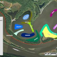
    3. Should we construct an island extension, as indicated on the map below? (This was discussed at the Stakeholder Workshops, but not included in draft maps)

    Screenshot 2018-03-08 16.44.13.png
    Benefit: Extending the island would provide ancillary benefits to recreational users. It would serve as a navigational guide for boaters susceptible to boat groundings in the area. Depending on its design, it could also be used for recreation.

    Cost: If implemented as an additional feature, it would raise the total project costs. If substituting another feature(s), it is unclear which ones and what the effect would be on official habitat restoration goals and objectives.

    LPLA Stance: We support adding this island extension (or a similar feature) to the final restoration plan. It will take strong public support to make this change. So, if you agree, make yourself known.

    4. Would you support some of the new islands or features being used for recreation?

    Benefit: It could provide a new recreational hot spot in Upper Lake Pepin. In doing so, it may attract and retain visitors to the area, thereby supporting local tourism.

    Cost: The feature would not be protected for fish and wildlife habitat. Management and oversight might be needed, which would require time and money. Possible congestion concerns, depending on project design.

    LPLA Stance: We support the use of recreation on, at least, one new island or feature. Final plans are needed before we can determine how many or which projects features would be suitable. Our criteria would include island construction, accessibility, and environmental cost.

    5. Catch all questions: Are there features you think are missing? Issues not being addressed? Or problems not accounted for by certain features?

    Lake Pepin Legacy Alliance

    PO Box 392, Red Wing, MN 55066

    Phone: 630.806.9909

    Email: [email protected]
    Tim Bossert
    Cochrane, WI
    Posts: 429
    #1763379

    As the river changes, “hot spots” and spawning areas come and go. By blocking the channel, new areas will emerge. They just need to be “found”. The fish, and those chasing them will adapt. Not a big concern to me personally on that specific topic.

    The more immediate concern is the lack of water to allow people to enjoy the river, but again it may offer more to be seen in the future with additional wildlife, plants, etc…

    Since I am not a daily driver of pool 4, I will leave it at that.

Viewing 7 posts - 1 through 7 (of 7 total)

You must be logged in to reply to this topic.