The weather thread

Viewing 30 posts - 1,531 through 1,560 (of 1,637 total)
  • Mike Schulz
    Osakis/Long Prairie
    Posts: 2263
    #2322684

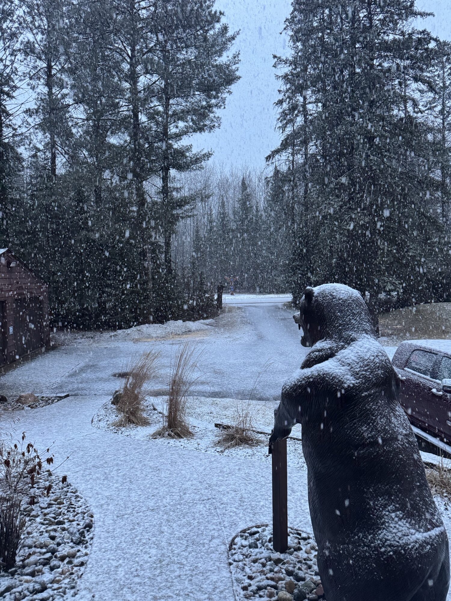
    not what it just said for here next saturday

    Sat 15 | Day
    36°
    78%
    NW
    25

    mph
    Watching a potential winter storm. Snow along with gusty winds at times. Morning high of 36F with temps falling to near 25. Winds NW at 20 to 30 mph. Chance of snow 80%. Snow accumulating 3 to 5 inches.

    gim
    Plymouth, MN
    Posts: 19192
    #2322694

    My apologies, the forecast I relayed earlier was for MSP. Your location may be different.

    It shows a high of 73 degrees on Friday, thunderstorms, and a rapid change on Saturday, with a high of 31 on Sunday.

    Mike Schulz
    Osakis/Long Prairie
    Posts: 2263
    #2322695

    all good just saying who knows until it’s over rotflol

    and interesting, MSP to here 120 miles maybe…

    gim
    Plymouth, MN
    Posts: 19192
    #2322726

    Now it does seem to indicate a transition from rain to snow later on Saturday at some point, nearly everywhere.

    Not before it reaches the 60’s today and nearly 70 by Friday.

    Eelpoutguy
    Farmington, Outing
    Posts: 11213
    #2322729

    Was out on the deck yesterday, bout 4pm the Farmers draintile opened up with a pretty good flow.
    A few minutes later a pair of Mallards showed up.
    It’s spring time.

    Jimmy Jones
    Posts: 3397
    #2322933

    At 3 this afternoon the digi was up to 71 degrees while the other was at 68. Love’n it. But my back yard beer cooler [snow] disappeared today. I guess I need to plug in the minifirdge I have on a work bench.

    glenn57
    cold spring mn/ itasca cty
    Posts: 13229
    #2322936

    At 3 this afternoon the digi was up to 71 degrees while the other was at 68. Love’n it. But my back yard beer cooler [snow] disappeared today. I guess I need to plug in the minifirdge I have on a work bench.

    Jimmy…..i was up in Itasca county this weekend…..i needed to put the ice shavings from the holes i drilled to keep my beer cold!!!!! doah chased

    Full draw
    Posts: 1742
    #2322990

    Truck said 72 today when I drove home from work at 5:30. It was great to work today in a T shirt.
    Decided to stop by the lake by town on my way home.
    The ice is pulling away from the shoreline.

    gim
    Plymouth, MN
    Posts: 19192
    #2323043

    The Friday/Saturday system track is expected to go right over the eastern half of the state. Which means all or mostly rain for that area and to the east, with possibly accumulating snow for western and northwestern MN on the back side with colder air.

    Last week, the track went through southern Wisconsin which created a bigger patch of colder air in most of MN, which resulted in more widespread snow.

    Also, air temps will be much warmer here when it arrives on Friday. The high is supposed to be around 70 degrees and there could be a thunderstorm or two.

    CaptainMusky
    Posts: 25214
    #2323046

    They are talking about a lot of drier air coming in on the back side so the snow, freezing rain will likely be minimal in most areas. Going to be windy (shocker) again.

    suzuki
    Woodbury, Mn
    Posts: 19060
    #2323091

    All I know is it has ruined my weekend plans. flame
    Now I have to stay home with my wife. cool

    glenn57
    cold spring mn/ itasca cty
    Posts: 13229
    #2323298

    jester

    Attachments:
    1. FB_IMG_1741715844767.jpg

    gim
    Plymouth, MN
    Posts: 19192
    #2323301

    rotflol

    Kinda creepy

    gim
    Plymouth, MN
    Posts: 19192
    #2323702

    The system coming in tomorrow may result in some heavy rain and thunderstorms. A transition will occur along the Dakota-MN border to heavy wet snow and accumulation in western MN could be up to 6-10 inches by Sunday morning.

    No snow accumulation is expected in central MN and areas to the east.

    Not before it’s nearly 75 degrees tomorrow. shock

    JEREMY
    BP
    Posts: 4596
    #2323804

    My yard dried up. Poor dog couldnt even find a mud puddle to roll around in yesterday.

    glenn57
    cold spring mn/ itasca cty
    Posts: 13229
    #2323822

    My yard dried up. Poor dog couldnt even find a mud puddle to roll around in yesterday.

    rotflol rotflol rotflol

    get the garden hose out !!!!!!!!! waytogo whistling

    suzuki
    Woodbury, Mn
    Posts: 19060
    #2323892

    Shorts and T-shirt. Yea. roll
    Making the best of if. Grilling tonight. Jon Jordan chicken!! yay

    James Almquist
    Posts: 713
    #2323997

    I have to believe that with the wind coming off lake superior I am going to get diddly squat out of this storm. Was hoping to maybe hear some thunder but now we will be lucky to get some rain. I don’t think it even hit 45 today. I checked and we hit 51 at 13:30.

    glenn57
    cold spring mn/ itasca cty
    Posts: 13229
    #2324020

    Enjoying the evening before all hello supposed to break loose.

    Attachments:
    1. 20250314_181242.jpg

    glenn57
    cold spring mn/ itasca cty
    Posts: 13229
    #2324023

    Enjoying the evening before all hello supposed to break loose.

    Attachments:
    1. 20250314_181242-1.jpg

    buckybadger
    Upper Midwest
    Posts: 9249
    #2324055

    Pretty good lightning display here in SE Minnesota.

    Crazy how “normal” this new weather is to have heavy thunderstorms in December and the first half of March. It’s very different than my younger years

    Mike Schulz
    Osakis/Long Prairie
    Posts: 2263
    #2324075

    rain and freezing rain here with some wind..

    Eelpoutguy
    Farmington, Outing
    Posts: 11213
    #2324081

    It’s pouring at the cabin.

    Makes my morning coffee taste better! waytogo

    Eelpoutguy
    Farmington, Outing
    Posts: 11213
    #2324082

    Check that –
    Just turned to snow.

    Attachments:
    1. Snow.jpeg

    James Almquist
    Posts: 713
    #2324084

    So far everything has been to the east of me. Looked at the history and we got .2 of rain and nothing but fog since I got up.

    gim
    Plymouth, MN
    Posts: 19192
    #2324357

    A system set to arrive on Tues/Wed could be interesting. Right now the storm track sends it through Iowa but southern/SE MN and western WI could see significant snow accumulation. The GFS model puts out over a foot of snow around Rochester. shock

    The more reliable European model has less robust snow totals but still puts the bullseye in the same area. Both models have the system just clipping the southern Twin Cities.

    The track could shift north or south before it arrives.

    buckybadger
    Upper Midwest
    Posts: 9249
    #2324376

    The last system brought thunder, wind, and 0.2” of rain here along Pool 4.

    It’s pretty early to place any bets on us staying in the bullseye for this one.

    gim
    Plymouth, MN
    Posts: 19192
    #2324835

    It shifted significantly to the southeast than what was forecasted just a couple days ago. I don’t think the twin cities is going to even get a flake of snow. And just 2 days ago, they said several inches.

    Weather terrorism at its finest smash

Viewing 30 posts - 1,531 through 1,560 (of 1,637 total)

You must be logged in to reply to this topic.