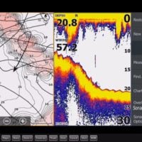
Here is what is coming out for Lowrance Live Mapping with SonarChart Live- What I know so far, subject to change…
¬ See below for effected units.
¬ Lowrance NOS 56 software update.
¬ Lowrance Units covered are-
⎫ HDS Gen 3 12, 9, 7 Version 4.5
⎫ Elite Ti version 2.5
⎫ Lowrance Carbon
¬ SonarChart Live data recorded in Lowrance and displayed live on screen.
¬ LSDCache file on the Navionics card.
¬ Active SCL Subscription is REQUIRED to see SCL data on Navionics card.
¬ SonarChart data is not recorded to the hard drive of the sonar, it is recorded to the Navionics card and Navionics card is required. (See below for required cards).
¬ Create High Definition 1’ contours.
¬ Requires a Navionics mapping card with an active chart update subscription (Freshest Data).
¬ No tolerance, if it was 3 ft. yesterday and 1 ft. today, it will start correcting to 2 ft today where you run the boat. Yes, as you can visualize that means it will draw a 1 ft. ledge in the middle of the 3 ft. flat. Without adopting level adjustment, that’s the result.
¬ Tide adjustment is there which does this automatically (same for Raymarine), but for freshwater there is no level adjustment. We can do it in the app but Lowrance and Ray opted not to implement.
¬ Plotter Sync requires an active Mobile subscription as well as card.
¬ Navionics Cards needed-
⎫ Hotmaps Platinum
⎫ Platinum +
⎫ Navionics +
⎫ Navionics + Regions
⎫ Navionics Updates
¬ Data recorded in Lowrance and stored on card is not shared to Navionics.
¬ Genesis/Lowrance nor Navionics gets NO LOGS or Data from Lowrance Plotter/Sonar. Data not shared.
¬ Adjust SonarChart contour density.
¬ Update Navionics Mapping card in Lowrance Plotter via WI fi connection between Mobile device and Plotter.
¬ Download updated charts and transfer routes and markers/waypoints via the innovative Plotter Sync capability of Navionics Boating apps without having to remove the Navionics card.
¬ If you choose to do SonarChart Live and want to update your Navionics SonarChart data on card or mobile device app you have to connect affected Lowrance Units via Wi fi to Navionics Mobile app and do SonarChart Live in the mobile device, which is then uploaded to Navionics and processed into the community SonarChart layer. You then do a Freshest Data update to card or mobile device.
¬ Wi-Fi required in sonar.
¬ The SCL file (LSD Cache) Q. How much recording can a user do with SCL on a plotter?
There is no limit other than the available space on the card. SCL consumes 20 kb per hour. The available time is the available free space on the card. 1000 KB in 1MB. 1000 mb in 1 GB. So, 1 GB of space = 50,000 hours of recording. Bottom line is, even a full card with a few MB of space remaining, say 5mb left, has 250 hours of recording space, more than enough for a couple years for most users.
¬ It will not record or overwrite present SCL Data if no changes are present.
¬ Plotter Sync requires an active Mobile subscription as well as card
¬ Plotter sync can not only transfer routes and markers but also update the card (download the chart updates in mobile before you sync using the “download map” function with rectangle).
¬ Added functions-
⎫ You can do plotter sync.
⎫ With Lowrance
⎫ Transfer Routes
⎫ Transfer Markers/Waypoints
⎫ Update Charts
⎫ Activate New Cards
⎫ Shallow Water Highlight.
⎫ Depth Highlight.
⎫ Minimum Depth- Adjust what SCL rendering treats as the safety depth. This affects the coloring of the SCL area. As the vassal approaches the safety depth, the SCL area will gradually change from the simple grey/white to red.
⎫ Easy View.
⎫ Transparency – The SCL overlay is drawn on top of other chart data. The chart data is completely covered at a minimum transparency. Adjust the transparency to allow the chart detail to be seen
⎫ Navionics Dock-to-dock Auto-routing creates intelligent, detailed routes, even through narrow passages and channels. (Only available outside the US)
