Thoughts?
The PDF above is not the final as it’s titled.
The biggest question in my mind is the draw down, but more on that later.
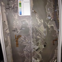
The islands behind Jackson Run aren’t set in stone at this time. There are at least 3 or 4 options.
If an island is created as in one suggestion, access to Twin Lakes will be cut off from water access (most likely). If they make a curved island as in the PDF above, it will force the delta to move down stream which will protect the deep water on the South side of the lake. It may keep the back side of Milies Run open as well.
I think most will agree that Brewers Cut had been growing over the years. Rip rapping to stabilize that shore line is a good thing.
I didn’t see anything in the plan for protecting the Buffalo Slough islands from flow or wave erosion.
The draw down.
A perfect execution of the plan would be for an 18″ draw down at the Red Wing Dam with a ZERO draw down at Prescott.
How that works is above by head but it has to do with Slope, Pivot Points, not too much flow, not to little flow and let’s not forget Mother Nature controls some of this.
I’m not going to go into details but I spoke with Dan Detterman, a MN DNR biologist that I have a huge amount of respect for since he’s been working on Pool 3 for…well a very long time. He feels that we should take what we can get for a draw down. “If it’s only 3″ for two weeks, take it” is his well informed thoughts.
I think the draw down concerns me because I don’t know anything about it. What fish/mussels will be affected for the short or long term. I can see the draw down helping water fowl and other birds but there’s that unknown portion for me at least.
That’s why I’m putting my trust in the guys that do this and have been doing this for many years. The up side to all of this is that Ma Nature could frown and change it all back with one good flood event.
A draw down won’t happen until 2017 at the earliest.
Attachments:

IMG_6321.jpg
