Navionics "upgrade" only half the river

  • oldrat
    Upper Midwest
    Posts: 1531
    #1614561

    So I am looking for an upgrade on my Lakemaster chip.. I fish almost exclusively in the LaCrosse area. this chip shows wing dams in an outstanding manner.. however the contour lines are light blue on blue background. accurate but hard to see .. to the point where as I still bring my Garmin Hand held in the boat because it shows MORE on a 3 inch screen and is easier to read.. So today I go to Navionics for the any chip upgrade.. and I chat with one of their reps.. SHE WAS GREAT.. but she told me to go to the website and actually see what shows on the river.. and I was shocked to see that anything on the Wisconsin side has depth contours but NONE on the Minnesota side of the river.. so none of the sloughs that run through out the lower end of the pool have contour lines.. as long as it was on the Minnesota side of the river .. the lines ended. I had the CC in my hand and was ready to buy when I discovered this.. you can’t go without contour lines.. and I can’t tell you how many times that little GPS saved my buns.. that 100 yards in a certain direction and suddenly DEEP WATER.. why in the wide wide world of sports would Navionics forget half of the river?

    KirtH
    Lakeville
    Posts: 4063
    #1614587

    Did you click on the icon on the lower left for the SonarChart layer, much more detail than the Gold or Premium layer.

    Give me an area and I will look at it.

    KirtH
    Lakeville
    Posts: 4063
    #1614588

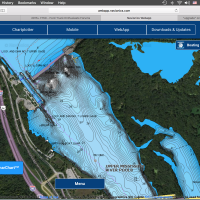
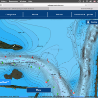
    Example shown

    Attachments:
    1. Screen-Shot-2016-04-19-at-9.01.32-PM.png

    2. Screen-Shot-2016-04-19-at-9.01.41-PM.png

    KirtH
    Lakeville
    Posts: 4063
    #1614591

    Shoot me a call or message if you have more questions

    oldrat
    Upper Midwest
    Posts: 1531
    #1614631

    go to the lower pool.. across from Stoddard.. there you will see that the mapping stops and miles and miles of river between the tracks have no contour”..

    KirtH
    Lakeville
    Posts: 4063
    #1614640

    What sonar do you have?

    KirtH
    Lakeville
    Posts: 4063
    #1614642

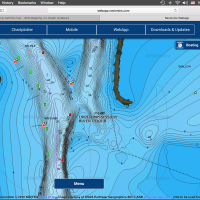
    Stoddard, some the backwater may not be mapped just due to accessibility and continuing changes. Similar to Pool 3 up here, I did some mapping work as did BK of the backwater areas up here.

    If you can run a Hotmaps Platinum its a great river chip with Satellite imagery, but you need a HDS or an upper end Hummingbird

    Attachments:
    1. Screen-Shot-2016-04-20-at-5.45.41-AM.png

    2. Screen-Shot-2016-04-20-at-5.45.00-AM.png

    3. Screen-Shot-2016-04-20-at-5.44.55-AM.png

    oldrat
    Upper Midwest
    Posts: 1531
    #1614855

    please take note of the old original sloughs from the main channel west toward Minnesota.. it shows them as dots.. but there are no depths.. but trust me even my garmin and a very old chip reveals the depths.. and the channels. got to have them, and can’t use a chip with out them. .

    oldrat
    Upper Midwest
    Posts: 1531
    #1614856

    or raft channel no depths posted for Raft channel..

    riverrat86
    Posts: 3
    #1618529

    Hi, I am new to this forum. But I’m glad to see stuff about local lakes and the Mississippi. I just a bought a Lowrance Hook 7 GPS unit. I fish a lot on the Mississippi in pools 5 and 6. What would be the best chip for me to go with that would show detail on the river?? I want to Be able to see wing dams on it and as much depth range as possible. Any help would be awesome. Thanks.

    hnd
    Posts: 1579
    #1623144

    their mapping of our pools in iowa and illinois are very poor compared to lakemasters. navionics good contour mapping stops at guttenburg tailwaters. sonar charts south of that seems like they made it up and the navionics only shows wingies and channel.

    i know rivers change, but the lakemater pool 14, 15, 16 maps are still pretty straight on after 5-6 years.

Viewing 11 posts - 1 through 11 (of 11 total)

You must be logged in to reply to this topic.