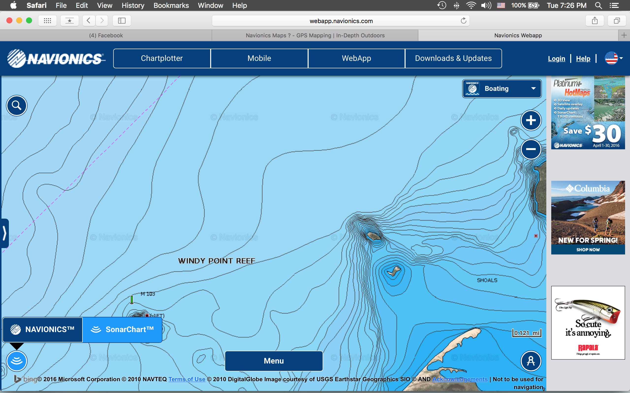
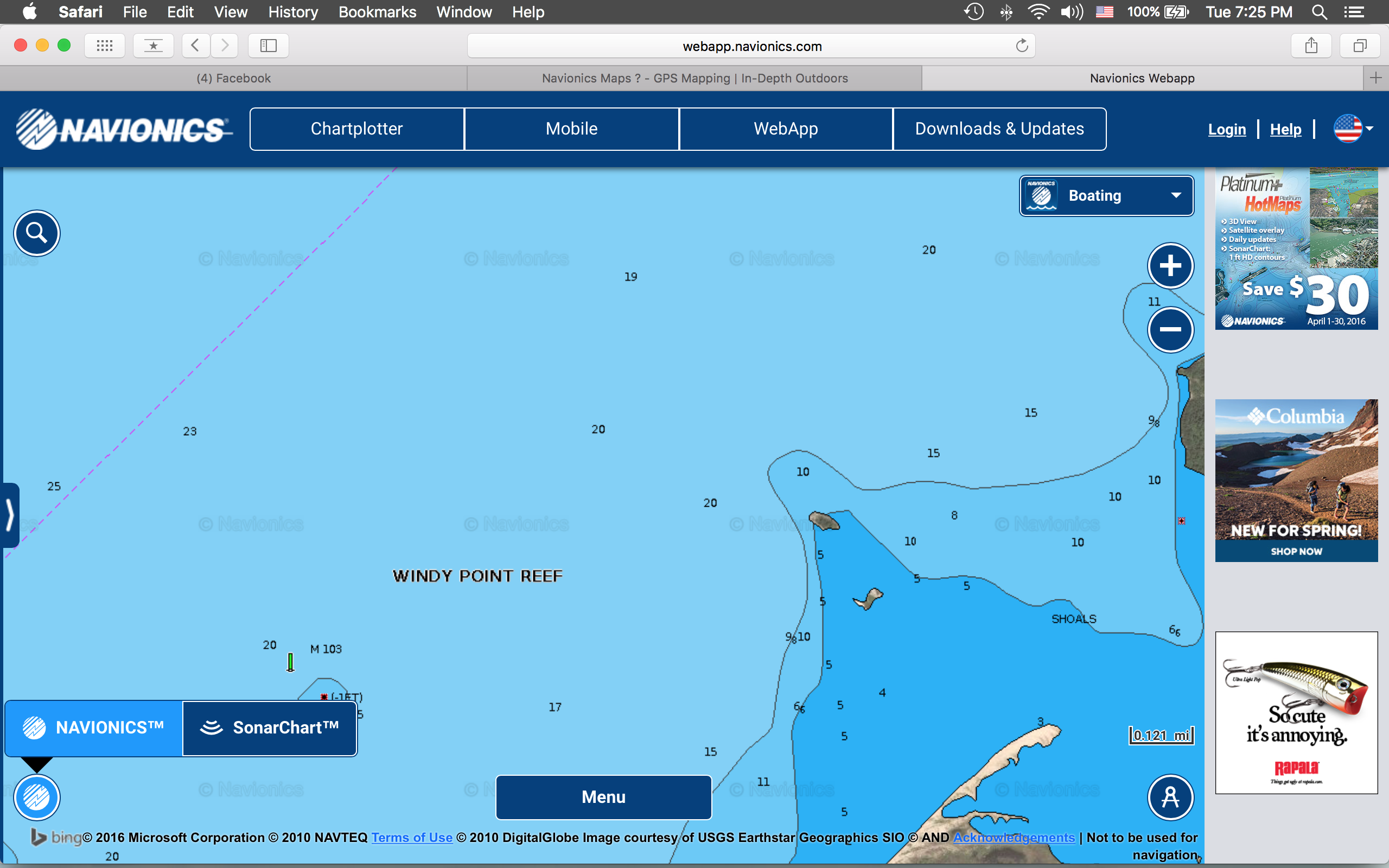
Go with Navionics+ it covers all of US and Canada one card. It comes preloaded with Gold or Premium mapping, you then download the High Def SonarCharet layer for the areas that you fish such as MN/Dakotas/Canada. You can preview the mapping online on the web app https://webapp.navionics.com/?lang=en#@6&key=orbpGbpzwP
After you zoom in on the lake of interest, click on the icon on the lower left for the SonarChart view. I attached some examples of LOTW
Attachments:
Screen-Shot-2016-04-19-at-7.26.00-PM.png
Screen-Shot-2016-04-19-at-7.25.56-PM.png