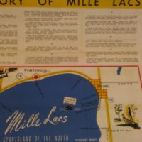
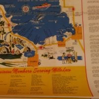
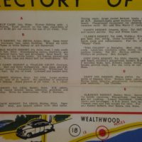
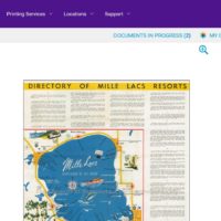
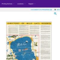
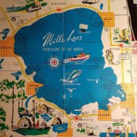
Cruising the web I came across this site. Here is a map showing the resorts on Mille Lacs in 1946. Cut & paste the link and you can then zoom in.
http://blog.renholland.com/wp-content/uploads/2012/05/540M-1-Mille-Lacs-Lake-ca-1946.jpg
IDO » Forums » Fishing Forums » Minnesota Lakes & Rivers » Mille Lacs Lake » Mille Lacs resorts……..where have they gone
Cruising the web I came across this site. Here is a map showing the resorts on Mille Lacs in 1946. Cut & paste the link and you can then zoom in.
http://blog.renholland.com/wp-content/uploads/2012/05/540M-1-Mille-Lacs-Lake-ca-1946.jpg
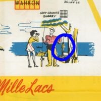
We used to use the Drive in Theater screen in Garrison to find the reef.
Get out to where you think it should be, line up the screen until it was just a sliver then throw on a daredevil. When you snagged a rock, You found it!
I have seen that map image before, but not with the complete directory…so this is very cool.
I would wager a fair amount if there was a way to reproduce/reprint this in original size in paper or print form, they’d sell fast and furious.
Johnson’s Portside posted the map portion on his FB page and was flooded with requests from anxious buyers. He was going to look into a possibility of reprinting but nothing came of it from a couple years ago. Copyright issues?
Where have the resorts gone? So much has changed since 1946 when life was simpler. Not just Mille Lacs, but most “ma and Pa” resorts have disappeared since 1946.
Ironically I feel this map is a snapshot of the entire northwoods. Many resorts having cabins sold of as condo type shared access. Others just shuttering and being turned into homes. Change is constant.
Interesting you mention that as I was a participant in that exact turnover quite a few years ago.
Back in 1992 or 93, we bought a small cabin on small lake in Iron County just outside Mercer. It was a small “ma and pa” resort with 5 cabins that they ended up selling out as the condo type arrangement.
It was the best $ I ever spent. Up there every other weekend with kids growing up, out exploring the woods and waters on their own.
For me, a boat tied to the dock where I could walk out, step in and go anytime during the day or night and plenty of muskies to boot.
We paid $24,000 when we bought it and I sold it little over 10 years later for $132,000.
I wasn’t passing judgement or lamenting the passing of those resorts. The purpose was for some of us older guys to remember names and locations of resorts from our youth or our parents lives. Also thought some of the younger guys might be interested on what the lake looked like when a trip to Mille Lacs was a vacation or a long weekend vs a day trip.
Many reefs and flats are named after resorts named after the owners.
Just a piece of history some might enjoy.
I have seen that map image before, but not with the complete directory…so this is very cool.
I would wager a fair amount if there was a way to reproduce/reprint this in original size in paper or print form, they’d sell fast and furious.
You can save the image as a jpeg, then send to FedEx/Kinkos to get an 18×24 print made, for $22. No telling how it would look though, after being blown-up thata much.
HRG
I have seen that map image before, but not with the complete directory…so this is very cool.
I would wager a fair amount if there was a way to reproduce/reprint this in original size in paper or print form, they’d sell fast and furious.
You can save the image as a jpeg, then send to FedEx/Kinkos to get an 18×24 print made, for $22. No telling how it would look though, after being blown-up that much.
HRG
You can save the image as a jpeg, then send to FedEx/Kinkos to get an 18×24 print made, for $22. No telling how it would look though, after being blown-up that much.
HRG
For $22 bucks all I have to lose is $22 bucks if it doesn’t work.
I’m willing to take that gamble, I’ve certainly wasted more money on even more foolish things.
Thanks for the info, I’ll give it a shot.
Just downloaded it and looked at the details, The image in the link posted has 4999×6540 resolution and is over 13mb. That’s better than most high end cameras. And zooming in shows just a little graininess at the very close levels. You’ll be good to go.
Yeah, you could go up around 30″ on the longest side and still get a really passable print just from the file dutchboy posted.
Just thought I’d report back on this.
Thank you HRG for the info, I would never have imagined that, but I went with everything you posted along with the image of the FedEx/Kinkos website you attached and bingo.
I ordered this morning at picked it up this afternoon.
It turned out better than I expected. Resolution, color, and clarity were probably as good as the original.
And thanks Dutchboy for starting this post, I have now found a long sought after treasure.
Here’s some pics of the final product. Might be hard to tell, but “tickle me pink”
That’s a great idea Andy! I think one of those would look great in the hard house!
Glad to hear the plan worked. Thanks for posting the follow-up.
HRG
This is a great find! Thank you for sharing it.
The listing of business members at the bottom shows how different the area towns were. For example it appears that Onamia had 3 grocery stores? Dahlgreen Bros., Groceries & Meats, Fairway Market, and Red Owl.
It sure seems like the towns were more vibrant then.
I was also surprised to see that the Spotlight Café in Garrison has been open that long.
Well there ya have it, no wonder why you old timers thought the fishing was so good back then, the standards were way lower!!
Bells Pebble Beach Resort on Big Point. The Bell family still owns a cabin on that spot. The resort long gone of course.
Also note there are several / many that are not listed. Must not have had any money in the advertising budget when that was printed.
-J.
Also note there are several / many that are not listed. Must not have had any money in the advertising budget when that was printed.
-J.
Jon,
There is another version of that map that I have seen that I’d also like to have a poster of. Image is below, although I’m not sure if it will reproduce in a larger format?
It has the same graphics without the directory on the side and bottom. But you can see this version lists far more establishments…compare the north shore between the two.
Perhaps the different versions were those businesses that paid to list in the local Chamber of Commerce?
Interesting history nonetheless…
As a FYI for the ice guys. I was looking at the map Andy got me (thanks again) and back then they were charging $1 to access the ice roads. Seems those ice roads are a bargain today @ $10!!
$1 in 1946 adjusted for inflation is $13.18 today.
Bells Pebble Beach Resort on Big Point. The Bell family still owns a cabin on that spot. The resort long gone of course.
Also note there are several / many that are not listed. Must not have had any money in the advertising budget when that was printed.
-J.
Was that what was later called Red Eye?
Most are $15
So yep…..$10 would be a bargain
$10 with AARP membership.
I am actually working on compiling what I can find of Mille Lacs Lake Resorts…Past & Present. I have a list of 200 resorts dating back to around 1903 (BayBiew). It’s actually about 250 different names; I combined the multiple names to one listing.
I’m about finished with a search of the steamers, tugboats, launches and scows that goes back to 1893 then I’ll be getting back to the Resorts!
I’m a co-founder of the Onamia Area History Club. We have a little presence on Facebook!
Very cool Denise. Seems as though you stumbled on an old thread. If you get to a point were there was a print available of what you have I would purchase it.
I have a framed old map of l eech lake and resorts, the kind that the chamber of commerce used to hand out, no idea on age, I am guessing early 50’s/ Very interesting and not PC at all, history
Well there ya have it, no wonder why you old timers thought the fishing was so good back then, the standards were way lower!!
Well back before all this co-management crap the lake went through cycles. As well it was difficult for the average guy to fish the flats as the boats weren’t very big, forcing most to stay near inshore structure. In the 80’s I remember taking an older gentlemen in his late 70’s fishing on Mille Lacs, who was going to California and wanted to take a walleye meal out with him. With my 14 foot Lund we were able to get to the north end of Anderson’s Reef. It was late June, we anchored and bobber fish eventually getting our 12 walleyes, nothing over 14 inches. Back then Mille Lacs had 2 nicknames…..The Dead Sea, and The Home of the Quarter Pounder.
You must be logged in to reply to this topic.