Lowrance Insight compared to LakeMaster

  • Brian Klawitter
    Keymaster
    Minnesota/Wisconsin Mississippi River
    Posts: 59998
    #1306693

    I’m not sure about you folks, but I’ve been pretty darn confused about what the difference is between the Lowrance Insight and the LakeMaster 2010 chips.

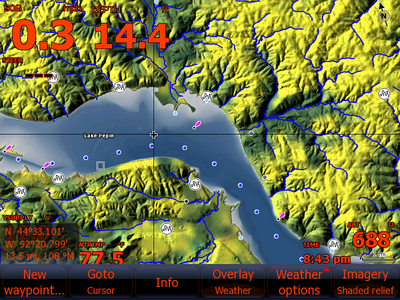
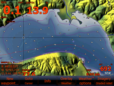
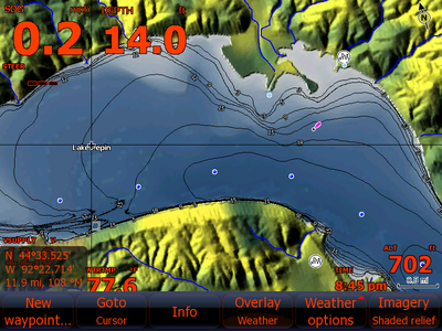
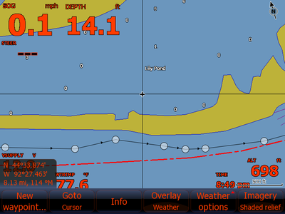
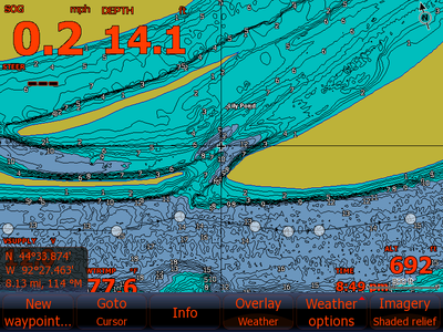
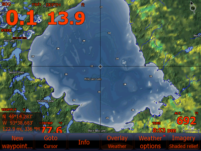
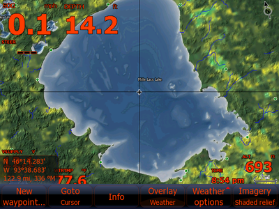
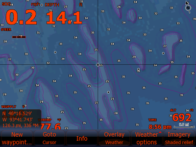
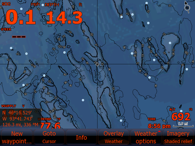
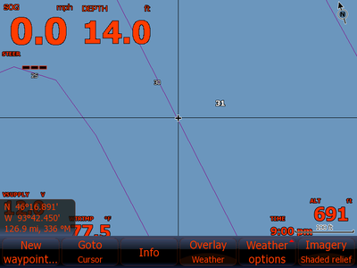
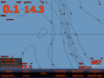
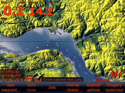
    The next few posts will have the Lowrance screen capture first and the second capture will be of the exact same location and zoom level, but with the LakeMaster chip.

    Post 1 and 2 are of Lake Pepin, post 3 is of the head of Lake Pepin and the last shots are of the Northern side of Mille Lacs near Jerry’s hump.

    By moving your mouse over the two smaller photos, it’s pretty easy to see the differences.

    Hope this helps!
    Brian Klawitter
    Keymaster
    Minnesota/Wisconsin Mississippi River
    Posts: 59998
    #886253

    Zoomed in more at the same location as above.

    Brian Klawitter
    Keymaster
    Minnesota/Wisconsin Mississippi River
    Posts: 59998
    #886255

    Some know this location as Fisherman’s Cut.

    Brian Klawitter
    Keymaster
    Minnesota/Wisconsin Mississippi River
    Posts: 59998
    #886256

    The Big Pond

    Brian Klawitter
    Keymaster
    Minnesota/Wisconsin Mississippi River
    Posts: 59998
    #886257

    Amount of zoom is in the lower right corner.

    Brian Klawitter
    Keymaster
    Minnesota/Wisconsin Mississippi River
    Posts: 59998
    #886260

    Last one.

    John Schultz
    Inactive
    Portage, WI
    Posts: 3309
    #886303

    Wow. Big difference on the one by Fisherman’s.

    perch_44
    One step ahead of the Warden.
    Posts: 1589
    #886312

    even if the two were exactly the same, i still would rather have the lakemaster chip, because it can then be used in other graphs, gps units, etc. you get more “bang for the buck”.

    Brian Klawitter
    Keymaster
    Minnesota/Wisconsin Mississippi River
    Posts: 59998
    #886331

    Yeah I should mention I didn’t scroll around looking for the largest differences.

    Just random locations on areas I knew many folks fish.

    MuskyTrap
    Posts: 60
    #886474

    You must be comparing LakeMaster’s 2D card to Lowrances 3D information. Correct?

    Brian Klawitter
    Keymaster
    Minnesota/Wisconsin Mississippi River
    Posts: 59998
    #886604

    That is correct sir.

    1st capture is always Lowrance INSIGHT

    2nd is Minnesota Version 6 by LakeMaster

    Brian Klawitter
    Keymaster
    Minnesota/Wisconsin Mississippi River
    Posts: 59998
    #886865

    More info:

    I used a LakeMaster Legacy card. This is a 2D card, which displays just fine on an HDS unit…in 2D. However, when I set the unit to show “Shaded Relief/3D” while displaying LakeMaster’s 2D information, I blended the Lowrance Shaded Relief coloring with LakeMaster’s high definition depth data. This is why the color changes don’t match the contour lines.

    This is most obvious on the second set of images.

    Note how LakeMaster’s contour lines do not match with Lowrance’ shaded relief color changes.

    I need to set my 8 for 2D presentation while using the LakeMaster Legacy card. Otherwise I’m seeing shaded relief that has nothing to do with the contour lines. (the shaded relief comes from public data which we all know misses the mark with accuracy in many cases)

    To see Shaded Relief in accurate high definition, it is only available on LakeMaster’s Insight digital map card.

    To be honest, I didn’t have any idea these images could blend together—two different maps, they don’t match.

    Bottom line is the captures aren’t apples to apples. I’ll have some better, more comparable captures after this weekend.

Viewing 12 posts - 1 through 12 (of 12 total)

You must be logged in to reply to this topic.