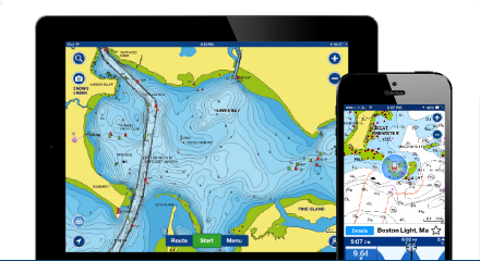
If anyone has any questions on using the Navionics Mobile App for ice fishing feel free to post your questions here.
Attachments:

Measuring-Distance.png

1507_boating_stripe_boating_4_0.png

Create-a-Route-From-Trail-Screenshot_2015-11-02-08-45-35.png
IDO » Forums » Fishing Forums » Ice Fishing Forum » If you are using the Navionics Mobile app for ice fishing and have questions…
If anyone has any questions on using the Navionics Mobile App for ice fishing feel free to post your questions here.

Measuring-Distance.png
1507_boating_stripe_boating_4_0.png
Create-a-Route-From-Trail-Screenshot_2015-11-02-08-45-35.png
Awesome. I am sure I will have some. I have loaded it but have not figured it out, or used it enough yet. THANKS, you will be hearing from me ![]()
I post some tips on some the features most commonly used or I use with screen shots. There is a slight difference between the Apple and Android platforms but the end result is the same. I run an Android phone and an iPad both with the app.
I would rec. some sort waterpoof case and float just in case you now what.
Great to see you’re still involved with Navionics. I loaded the app right after the Holidays last year and tried using it a few times. Seemed like at first it worked and then I Couldn’t get it work properly. We communicated a couple of times, but I never did get it working. Tryed using it in the boat a couple of times this season. Never worked. I’m guesssing it’s probably operator error. Now that it’s almost ice season I need to really try and get this figured out. Hopefully I can talk to you or someone else on IDO that has had success in using navionics. I have an apple I phone.
Swell, Let’s start with a basic. How do I save a waypoint without sharing it with the universe? Thanks
x2 on GoldWinger’s question. Also is there a way to improve it’s accuracy? I use it on my Droid, but it seems to be off by a few hundred feet. Still useful to get you in the right area, but would prefer not having to drill a ton of holes to find the exact spot I’m looking for.
x2 on GoldWinger’s question. Also is there a way to improve it’s accuracy? I use it on my Droid, but it seems to be off by a few hundred feet. Still useful to get you in the right area, but would prefer not having to drill a ton of holes to find the exact spot I’m looking for.
That is a problem associated with phones is how to improve accuracy. Garmin does have external GPS module called the GLO Bluetooth gps module. I have talked to couple guys and have read this does wonders for accuracy http://www.thegpsstore.com/Garmin-GLO.aspx?gclid=CjwKEAjwh8exBRDyyqqH9pvf1ncSJAAu4OE3ovD9U_W7oVgUE6lk6rEjqn4TNM2jd7WMHbiPQN6v0RoCnYbw_wcB
Swell, Let’s start with a basic. How do I save a waypoint without sharing it with the universe? Thanks
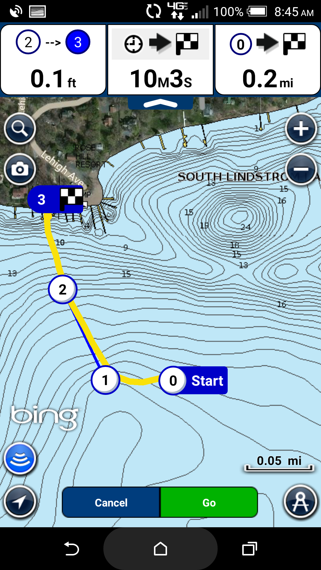
There are 2 ways to save a point of interest one is community edit which is available to all to see. If you look at your screen you see various icons and if click them you will see Joe the catfish guys spot. (Who fishes catfish? ![]() ) The other is called a Marker which is private to you and if you want to send it someone. See the screen shots. Tap and hold the screen a cross hair comes up, drag it to where you want a waypoint/marker, tap on question mark, tap add to favorites, name it, then click add or if your standing where you want a waypoint set at current position.
) The other is called a Marker which is private to you and if you want to send it someone. See the screen shots. Tap and hold the screen a cross hair comes up, drag it to where you want a waypoint/marker, tap on question mark, tap add to favorites, name it, then click add or if your standing where you want a waypoint set at current position.
Or if you want to add a waypoint/marker manually tap on the spy glass at the top the map screen on the next screen look of “Lat/Long” on the top right and you can then dial in your waypoint/marker and save it
All achieved or saved marker/waypoints are found by tapping the menu tab and your saved tracks, routes and markers archive will be shown

WaypointScreenshot_2014-12-11-07-17-17.jpg

WaypointScreenshot_2014-12-11-07-25-13.jpg

WaypointScreenshot_2014-12-11-07-26-47.jpg

WaypointScreenshot_2014-12-11-07-17-38.jpg

Menu-Tracks-Routes-etc.png
Kirt, does that Gamrin GPS bluetooth module turn my smartphone into a Handheld GPS even when there is no cell service?
Great to see you’re still involved with Navionics. I loaded the app right after the Holidays last year and tried using it a few times. Seemed like at first it worked and then I Couldn’t get it work properly. We communicated a couple of times, but I never did get it working. Tryed using it in the boat a couple of times this season. Never worked. I’m guesssing it’s probably operator error. Now that it’s almost ice season I need to really try and get this figured out. Hopefully I can talk to you or someone else on IDO that has had success in using navionics. I have an apple I phone.
We will get you dialed in
Kirt, does that Gamrin GPS bluetooth module turn my smartphone into a Handheld GPS even when there is no cell service?
Yes, most cell phones do have a built in GPS probably not the most accurate though.
Here is a tip if you are traveling outside of your phone coverage or data coverage area like the BWCA for example. The app uses your cell coverage to keep the map updated on your screen, but once you are out cell coverage you SOL, but here is a way to fix that. If your mobile device has a built in GPS most do or get an external antenna.
You can actually download an area or lake when you have coverage or wi fi and still use your mobile device like a handheld gps outside your cell coverage area. See screenshots but you download and area to your device. There is not a list of downloaded areas shown but if you turn off your wi fi you will see a shaded zone that is downloaded. Once you lose cell coverage the area boxed in will be shown just like a map card in a HH gps.
The downloaded areas are permanently stored on your device

Download-MapScreenshot_2015-11-01-06-33-42.png

Download-MapScreenshot_2015-11-01-06-33-26.png
I’m going to have to buy that GPS module. I could use my phone in Canada for both lake maps and hunting GPS. I just have to download a big enough area map. Thanks Kirt, that’s awesome.
My iPad is only wi-fi, not cell compatible. But I can tether it to my iPhone or download the maps and use the iPad in the Argo for ice fishing maps.
I have both the usa and usa Canada app because of the USA android not having the foot increments like apple had right of way so I got the usa Canada app. So both have expired now and the usa Canada app still has waypoints I have entered over the years and all of my USA app waypoints are gone. How do I recover them? Thanks
All the data is stored in your phone so if you lose your phone or switch phones that data is lost UNLESS you created an account with Navionics and checked Sync My Data. What happens when you do this all your info is stored on the Navionics Cloud or Server and it is kept private to you not shared. So if you lose your phone and reload the app or if you have multiple devices example I have and Android phone and an iPad and both are registered to my account and data is automatically shared between the 2 and saved off the device

Sync-My-Data-IMAG0669.jpg

Sync-My-Data-IMAG0668.jpg

Sync-My-Data-IMAG0667.jpg

Sync-my-data.png
I’m going to have to buy that GPS module. I could use my phone in Canada for both lake maps and hunting GPS. I just have to download a big enough area map. Thanks Kirt, that’s awesome.
My iPad is only wi-fi, not cell compatible. But I can tether it to my iPhone or download the maps and use the iPad in the Argo for ice fishing maps.
Are you sure your cell’s GPS doesn’t work off the cell grid, Wade?
I’ve used mine in Canada where there is no cell coverage and it works fine. The issue with Navionics and any other mapping program is the map has to be downloaded and stored on your phone. Once your phone is off the cell network, it has no way to download new maps.
Maybe with an iPhone it’s different, but with my Android the GPS works all the time, with or without a cell signal.
Grouse
While fishing in Canada its important to do exactly what Grouse said, download maps of lakes you intend on fishing while on a wifi or within your cell network. When fishing in Canada open the Navionics app, turn GPS on and you are good to go, at least on my Android.
I had a bunch of waypoints saved and I recently did the latest update and they were all deleted. Is there a way to prevent this in the future? Luckily I had them saved in my handheld gps also.
I had a bunch of waypoints saved and I recently did the latest update and they were all deleted. Is there a way to prevent this in the future? Luckily I had them saved in my handheld gps also.
Read the post 3 up about sync my data
The navionics app works pretty good on my galaxy s3. It works way better than the one in my helix 5 si gps. The helix would be off over 1000 feet at times when I really needed it to navigate the river at night in the fog. Very disappointing. But the navionics app on my phone was right on all the time.
When we are dowloading maps for offline use, do we need to be zoomed in on the lake or can we grab a wide region with multiple lakes?
Well now I gone and done it. I have the same phone as I have always had. I synced everything. I’m assuming USA and USA Canada won’t sync with each other on the same device or any other device. Now what I have done is lost my 1ft increments on my USA Canada app and I am stuck on 3ft with no options in map options. I did restore purchases and upgrades so I don’t know if that had anything with it, but I still don’t have markers on my USA app and now I have 3ft instead of 1ft on my USA Canada. FML
Well now I gone and done it. I have the same phone as I have always had. I synced everything. I’m assuming USA and USA Canada won’t sync with each other on the same device or any other device. Now what I have done is lost my 1ft increments on my USA Canada app and I am stuck on 3ft with no options in map options. I did restore purchases and upgrades so I don’t know if that had anything with it, but I still don’t have markers on my USA app and now I have 3ft instead of 1ft on my USA Canada. FML
On the Map page look for the Sonar Icon tap on it and select SonarChart that will give you much more detail
It should sync I have US on my Android and US and Canada on my iPad and mine sync
When we are dowloading maps for offline use, do we need to be zoomed in on the lake or can we grab a wide region with multiple lakes?
DOWNLOAD MAP
Tap on “Download Map” and you are brought back to the map. Use the pins that appear on the screen to move around the map and select the portion of map you wish to download. When you select an area that would take too long to download, the text on the “Download Map” button changes to “Too Large a Map” and you must reduce the selection. Downloaded Maps appear highlighted and are permanently stored on your device. You cannot download maps outside of the region you purchased.
DOWNLOAD MAP BY ZOOMING
In alternative to the above, zooming and panning onto an area of your interest, a detailed map starts downloading. The downloaded map is as large as the area covered in your current screen and download can take some time. Downloaded Maps appear highlighted and are permanently stored on your Android device.
I guess I don’t know what to do. I can’t figure out how to recover the lost waypoints after my subscription ended which didn’t do on the other app and now messing around US Canada is won’t go back to 1ft increments. No matter if I’m in sonar charts or navionics. Not very happy. When you sync does it put waypoints from both on each others app? Do I need to renew my subscription for any of this to work?
There are 2 ways to save a point of interest one is community edit which is available to all to see. If you look at your screen you see various icons and if click them you will see Joe the catfish guys spot. (Who fishes catfish?
) The other is called a Marker which is private to you and if you want to send it someone. See the screen shots. Tap and hold the screen a cross hair comes up, drag it to where you want a waypoint/marker, tap on question mark, tap add to favorites, name it, then click add or if your standing where you want a waypoint set at current position.
Or if you want to add a waypoint/marker manually tap on the spy glass at the top the map screen on the next screen look of “Lat/Long” on the top right and you can then dial in your waypoint/marker and save it
All achieved or saved marker/waypoints are found by tapping the menu tab and your saved tracks, routes and markers archive will be shown
Is this feature available when you buy the base Boating USA app or would I have to upgrade to Navionics + to have the ability to create waypoints on the contour maps?
I guess I don’t know what to do. I can’t figure out how to recover the lost waypoints after my subscription ended which didn’t do on the other app and now messing around US Canada is won’t go back to 1ft increments. No matter if I’m in sonar charts or navionics. Not very happy. When you sync does it put waypoints from both on each others app? Do I need to renew my subscription for any of this to work?
Your subscription running out doesnt effect your waypoints as long as do a sync my data, without registering Navionics has no idea who you are and can’t save your data on their server. If you haven’t done this and you switched phones or lost your phone they can’t help you, that data is stored on your phones memory. Did you do a sync my data on both devices?
What phones, iPads etc do you have the app that would help? I am confused need more info on your devices
<div class=”d4p-bbt-quote-title”>KirtH wrote:</div>
There are 2 ways to save a point of interest one is community edit which is available to all to see. If you look at your screen you see various icons and if click them you will see Joe the catfish guys spot. (Who fishes catfish?Or if you want to add a waypoint/marker manually tap on the spy glass at the top the map screen on the next screen look of “Lat/Long” on the top right and you can then dial in your waypoint/marker and save it
All achieved or saved marker/waypoints are found by tapping the menu tab and your saved tracks, routes and markers archive will be shown
Is this feature available when you buy the base Boating USA app or would I have to upgrade to Navionics + to have the ability to create waypoints on the contour maps?
Its available on the base level
I am using the phone I downloaded both apps with. About the time my subscription ended I checked the app again and my waypoints were all gone. Like you said my other app has its waypoints on it still after it expired. Is there a way to recover them if it is on the phone or did I delete all of the points somehow in my memory? I never did sync my phone.
I am only using only one device I wasn’t clear earlier when I asked if the two apps sync on the same device and share waypoints on the same lake because I do have some of my other waypoints on my US Canada app still?
My other issue was today when I was going through the syncing steps I saw the restore purchase and upgrades and I did it on my US Canada one and now I can only get 3ft increments instead of 1ft increments on the map. I can’t find how to change it to 1ft.
Thanks for listening and trying multiple times with me today.
You must be logged in to reply to this topic.