Ideas

  • Jake D
    Watertown, SD
    Posts: 545
    #1650734

    I would like to get 2 new graphs for my boat and have really been impressed with the garmin units. I’m looking at the echomap series either the 93sv or 73sv. I’m wondering what would be the best way to go on my tiller for having one of these used as a primary gps/2d and one primary for side imaging and down imaging. What would be the best way to network these as well as to get them on par for my terrova, if that is possible?

    nhamm
    Inactive
    Robbinsdale
    Posts: 7348
    #1650737

    From what I was told the 93 and 73 as far as the guts are involved are identical, screen just bigger.

    I’ll eventually be getting another graph for what you are looking to do as well, but it will be a bird or lowrance strictly for the reason to get Nav+ or a LM chip. Not impressed with the lakevu maps and with the recent court cases with garmin don’t see the compatibility coming anytime soon either. Sonar and side is fantastic though, and more than willing to have my 73sv next to anything just for the awesomeness that I find the unit to be.

    Jake D
    Watertown, SD
    Posts: 545
    #1650748

    nhamm,
    that’s a good idea too. I can use the garmin for sonar and SI/DI and then use a bird to run the mapping and hook up to the terrova. only downfall would be the waypoints wouldn’t show up on both

    Danny Thompson
    Minnesota
    Posts: 45
    #1660163

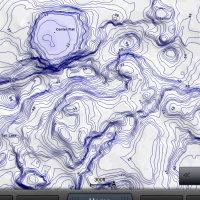
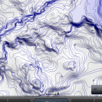
    Hey guys! Now Nav+ and LM do have great mapping remember one benefit Garmin has by doing mapping on their own is they are not stuck to one brand or type of map so you get the best of multiple maps so to speak. Also if you think an area needs better mapping QuickDraw (the ability to draw 1′ contour maps) is completely free and already built in…No need for subscriptions and expensive chips to do it! Now I am partial of course but I have found that the mapping is the same or even better in most cases it is just displayed differently then what most people are used to. Take a look at contour line for contour line and the maps are pretty good. Other thing to notice when looking at the mapping especially at a retailer is the map settings from Normal to Most can make a huge difference on many lakes and with Garmin you the get the option of the LakeVu Ultra card which makes the map 3D, gives you AutoGuidance and has MaxDef lakes!! In Minnesota we have Winnie, Cass, Bemidji, Vermillion, White Bear, St. Croix, Minnetonka…These lakes were mapped with a Garmin Mapping boat and are the most accurate map that has ever been made of these lakes and there is some cool feature like underwater snapshots built in. I for sure agree with you that some lakes are better between different brands of maps but I don’t want you to write off Garmin mapping without seeing it to its full potential.
    Danny Thompson
    Minnesota
    Posts: 45
    #1660167

    Screen Shots

    Attachments:
    1. IMG_2258.png

    2. IMG_2257.png

Viewing 5 posts - 1 through 5 (of 5 total)

You must be logged in to reply to this topic.