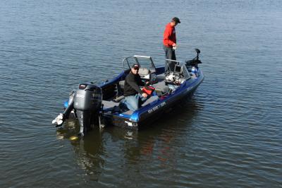
Ever cruise around a lake with eyes glued to the sonar and say, “That’d be a great ice-fishing spot?” I was doing just that a few weeks ago when up in Grand Rapids with a buddy who kept asking, “Why?” At which point we dropped an underwater camera and confirmed just “why.”
You’ve probably seen it discussed, the idea of using an underwater camera to dial in winter spots during this time of year, but maybe not in enough detail to use it as an actionable piece of information. It’s not as easy as just driving around and dropping the camera each time you see a fish. At the same time, it’s not too much more complex either, and spending just a bit of time in the fall makes it way easier to find and catch fish coming out of the gates this winter.
Fall is the best time to find your first-ice-bite. Let’s look at why:
- First off, the most glaring reason in my opinion, is that you can cover and eliminate much more water from a boat than you can on-ice. From shallow weeds to deep rock, you can “learn” structure and cover in a big chunk of territory, finding new areas along the way.
- Along the same lines, covering single pieces of structure from multiple angles, multiple times gives you much better insight of not just where it is located, but how it lays out. This is extremely important on-ice, especially for big pieces of structure.
- Fish are staging, and for many species, will be, or are-in, the areas they’ll be for first ice. How nice would it be to find the crappies weeks before you intend to fish them, walking on the ice for the first time with confidence that they’ll be there waiting?
- Ice angling brings ice-colony type pressure to community spots and well-known fishing locations. Using electronics to aid in your search will not only give you a great many “plan-B’s,” it’ll give you the confidence to head to a community spot knowing you’ll be targeting the very best location on that spot.
The “Why” part is easy. “How” is what’s most important. Just like doing too many things at once can lead to you doing them all poorly, fishing while scouting can distract and alter your opinion of ice-spots. The goal here is to find fish, yes, but more importantly, help you to decipher old locations and find new ones. That said, certain bites, like post-turnover fall crappies, and full-moon walleye trolling are great ways to lock-down locations of those species for the months to come. Make sure to use these locations to their full potential, as weedy fingers that give up fall walleyes at night, are great early season spots that you’ll be able to find those same fish come December.
Start first, by utilizing GPS/Sonar at known or proven locations. Waypoints that you’ve already collected aren’t areas to call “good,” they’re the starting point for making good locations better. If these locations are structural in nature, use sonar, paying particular attention to bottom hardness as you drive over the reef, hump, or underwater point several times from several locations. If your GPS track doesn’t resemble a plate of spaghetti after 15 minutes, you’re not covering all your bases. Spend time away from the edges too. Some of the best locations I fish every winter are off structure a ways. On Mille Lacs for example, my best perch and walleye locations are typically off of the large rock/gravel humps, and where those substrates intersect good bug-holding mud. Check out only the rocks and nearby sand, and you miss the line from mud to sand. These locations can be virtual milk-run spots, which fish follow to other locations like a buck will follow a fence-line.
Make careful note of outliers – rocks, mud spots or soft bottom within, gravel, neck-downs, sand, etc. Anything that doesn’t look what’s directly adjacent needs further viewing. This is where the underwater camera comes into play. The best sonar minds in the world are often fooled by subtle bottom content transitions, clam beds that look like gravel, mud spots that look like sand, etc. Directly resist the temptation to use GPS/Sonar exclusively, and confirm all locations with your underwater eyes. When you do use sonar, use waypoints, but label them intelligently. Fish016 means a whole lot less 2 years removed than does sand_rock_eye. Also, make sure to end your sonar sessions with a full waypoint cleanup. All of us are guilty of a GPS unit chock-full of waypoints that are virtually meaningless.
Shallower water is where panfish anglers get to make note, and map, the same weeds they’ll be fishing come ice-up. Not just locations of weeds, but species of weeds. Cabbage and coontail are tops in my book for finding panfish, and weed edges are just the beginning. Isolated pockets of key weed species, particularly cabbage, are tip-offs to certain substrates that will hold fish even once they’ve died back. Healthy coontail edges, pockets, and especially inside-turns adjacent to deep water are where I start my search for early season bluegills.
Seeing weeds from the boat is just the beginning. Seeing them from underwater is the premium. Most people assume a weedline is formed only because those weeds lose available light at depth. This is primarily true, but abrupt changes in weedlines like the very points and inside-turns you’re looking for are more often caused by bottom content changes. To find these, I like to run my boat at 5-7mph outside the weedline and parallel to it. Bottom content changes are easy to see on a quality color GPS/Sonar combo, and they’ll often continue far off the edge of the weedlines, especially in the case of underwater points. Look at your bottom, and as soon as you hit harder or different bottom, drop a waypoint. Then, fully investigate shallower towards the weeds and deeper towards the tip of the structure with your underwater camera.
Crappies are a species that are difficult to find in large basins come winter, as they truly can be the needle in the haystack equivalent when trying to drill hundreds of holes over large expanses. Perhaps no species is more easily found in the fall for winter angling than post-turnover crappies. At this time, crappies head to their wintering holes, and finding them with a boat is far-far easier than with an auger and flasher. In this deeper water, with any relatively decent clarity, it’s also easy to drag your underwater camera through the school to confirm what you’re seeing.
Hopefully these tactics are some that you employ in the next few weeks. Not only have they helped me in better learning old/new spots, they’ve helped me learn a great deal about fish locations in general. Consider it fishing homework that’s far more enjoyable than any you did back in school, with the payoff being successful angling for years to come.
Joel