Sorry I’ll try and clarify
I not using and Zero Lines or Lake Master SD Cards, Just the internal memory.
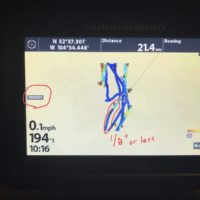
When I turn on Auto Chart it sets the zoom to 1000 ft. It starts working but the track is only an 1/8″ wide, Can barely see it. If I zoom in is goes blank and doesn’t show any Auto Chart. I have done a grid pattern at 1000 ft. but is doesn’t make any kind of map. It does show some depths.
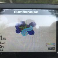
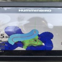
I watched many videos and they show zoom to like 200 ft or closer while making a track. The track is like 5/8″ wide.
If I put my unit in simulation mode it allows to to zoom in to 200 ft. and looks like I expect it.
I see what you meet by it missing the depth. I unit is factory set. I will try and find out how to change it.
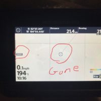
The reason I’m zoomed to 1000 ft is because it is the only zoom level that shows the auto track. In or out and it disappears.
I’m usually in 15-40 ft of water.
The 1/8″ track picture is the only thing I can get show me, if I change the zoom it disappears. The other pictures with the wide tracks is in simulation mode and what I expect.
I’ll look into the depth that’s missing
Thanks
Attachments:

fullsizeoutput_374c-1.jpeg

fullsizeoutput_374a-1.jpeg

IMG_2531.jpeg

fullsizeoutput_3744-1.jpeg