Finding bottom changes w/ Humminbird Side Imaging

  • jhalfen
    Posts: 4179
    #1294942

    One of the more common questions I’ve been receiving lately is, “can Humminbird Side Imaging be used to find transitions in bottom type….hard to soft, sand to gravel, etc?”

    The answer is, “absolutely”. And it does so without having to drive directly over the transition. As long as the transition is within the range of the Side Imaging sonar (up to 240 feet on each side of the boat), you can spot these types of transitions with ease.

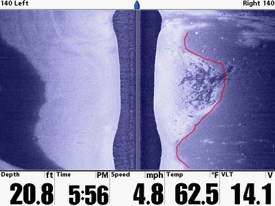
    Here’s one example. This transition is from hard packed sand to muck. The sand, because is reflects more sonar energy, appears brighter. The muck, because it is a better absorber of sonar energy, appears darker. The bright-to-dark transition, therefore, marks the boundary between sand and muck. If you’re having trouble seeing it, look for the red line in the second image.

    Here’s something else to remember: once you see the transition on your screen, you can freeze the image and drop waypoints all along the transition. Then, come back and focus your bait presentation all along that separation between bottom types.
    jhalfen
    Posts: 4179
    #836315

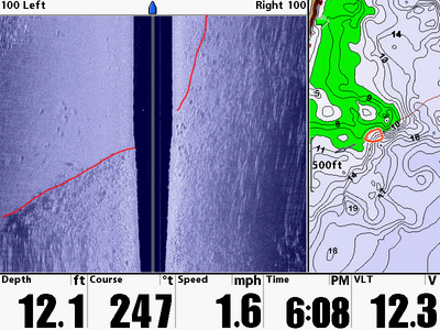
    Here’s another transition, this one from gravel to sand. Gravel, and rock in general, is so well imaged by Humminbird Side Imaging that these sorts of transitions will simply leap off your screen.

    This particular transition is in the NW corner of Mille Lacs, with the cartography on the right provided by the Lakemaster for Humminbird MN chip. The green color on the chart marks the range of depths that I’ve chosen to highlight (6-10 feet)…a Lakemaster exclusive for Humminbird owners.

    jhalfen
    Posts: 4179
    #836316

    One more, and this one is also as plain as the nose on your face.

    This transition is a weedline, again from Mille Lacs. Humminbird Side Imaging does a fantastic job of defining weedbeds, as well as their all-so-important inner and outer edges. Again, dropping waypoints on the edges allows you to execute picture-perfect trolling passes for those edge-oriented predators.

    In this particular image, weeds are found to the right, the outer weedline is (nearly) under the boat, and it’s mostly weed-free to the left.

    fishthumper
    Sartell, MN.
    Posts: 11931
    #836526

    That is way cool. I wish I’d taken a closer look at HB when I bought my new Lowrance last spring. Given all the issues at Lowrance lately I know my next unit is going to be a HB for sure. Given their track record as of late I may be in need of a new unit sooner than I want to be. Oh well then I can get a new HB. Thanks for all the Info and detail that you share with us. Keep up the good work and keep the info. comming.

    woody
    Onalaska Wi.
    Posts: 58
    #836732

    Jason, just wanted to thank you for all the instructional info on using side imaging. I’ve been using a 797c2 and thanks to you and some of the other Humminbird guys the uses and information that can be obtained seems endless. I’m thinking of upgrading to a newer bigger unit, I understand that the detail is a little better on the bigger screens and I don’t think my 797c2 is one that can be upgraded to use the Lakemaster maps. Thanks again Jason

    Tom P.
    Whitehall Wi.
    Posts: 3526
    #836794

    Woody I have the 797csi and yes the new update lets us use Lakemster maps. Just need to buy the map card for Humminbird and Lowrance chips will not work.

    jhalfen
    Posts: 4179
    #836994

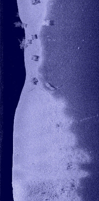
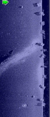
    Here are a few more soft/hard bottom transitions I’ve found as I’ve dug through my library, in preparation for the spring seminar season.


Viewing 8 posts - 1 through 8 (of 8 total)

You must be logged in to reply to this topic.