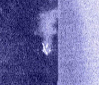
Side Imaging quiz: can you identify this?

  • jhalfen
    Posts: 4179
    #1294852

    I thought we’d have a little fun…

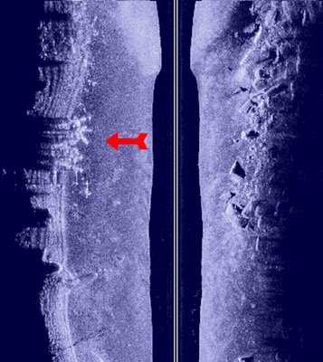
    I imaged a portion of Wissota that I had never visited previously this week, and saw a set of Side Imaging returns that were new to me. I checked this object (marked by the red arrow) after I imaged it, so I now know what it is.

    My question to you guys is….what do you think it is??

    I’ll reveal this object’s true identity sometime after lunch tomorrow (Friday).
    big_g
    Isle, MN
    Posts: 22386
    #797344

    TV Antennae, roof type ???

    big G

    ssaall
    Posts: 109
    #797350

    I’ll guess its boat props cutting a path through the weeds to a dock…..

    Brent Yeakey
    Bloomer, WI
    Posts: 553
    #797351

    Drag marks from lower units?

    minnbassboy
    Rochester Minnesota
    Posts: 11
    #797355

    People swimming at a beach?

    Dave Koonce
    Moderator
    Prairie du Chien Wi.
    Posts: 6946
    #797357

    Downed trees ?

    jhalfen
    Posts: 4179
    #797360

    Quote:


    People swimming at a beach?


    Nope, this is what someone swimming looks like

    rembrant
    Waterloo,Iowa
    Posts: 168
    #797362

    Boat ramp

    KirtH
    Lakeville
    Posts: 4063
    #797371

    Rock slide rip rap that had slid down the bank

    bigpike
    Posts: 6259
    #797374

    A very large crown with one of the spokes bent up….

    bosman
    DeSoto, WI
    Posts: 914
    #797378

    ICE forming! Get the strikemaster Bret!

    Pete Bauer
    Stillwater, MN
    Posts: 2599
    #797384

    Quote:


    Side Imaging quiz: can you identify this?


    Nope

    jhalfen
    Posts: 4179
    #797393

    Nobody’s got it so far.

    Perhaps a hint:

    The maximum depth in this area is 9 feet. The object we’re trying to identify sits in 3-4 feet of water.

    big_g
    Isle, MN
    Posts: 22386
    #797395

    crappie bed ???? old christmas trees ????

    big G

    nick
    Lakeville, MN
    Posts: 4977
    #797397

    Weed roller?

    kinny
    Posts: 21
    #797401

    I dont know.

    But it 1) is hard, like steel,concrete, or wood. My guess is it isnt wood. The image looks too bright to be wood. 2) it comes all the way to the surface. although I dont know for a fact that it goes all the way to the bottom.?? 3) it is not one solid piece, the SI can see between them and still give an image of the bank.

    If I had to make a guess I would say it looks like a public fishing pier.

    Tom P.
    Whitehall Wi.
    Posts: 3518
    #797404

    It looks like some kind of wall structure and part of it caved in.

    sootie
    arcadia wi,
    Posts: 213
    #797410

    somebody left their reel weeds in the lake!!!!

    Brian Klawitter
    Keymaster
    Minnesota/Wisconsin Mississippi River
    Posts: 59992
    #797411

    That’s easy Jason. I’ve seen many cards like that at the Dr’s office.

    Two nudes making out.

    KirtH
    Lakeville
    Posts: 4063
    #797428

    Quote:


    That’s easy Jason. I’ve seen many cards like that at the Dr’s office.

    Two nudes making out.


    redrnger
    Posts: 216
    #784030

    I would say a barbed wire fence,with weeds on it and a part of it has fallen.

    dave53
    Altoona, WI
    Posts: 132
    #784032

    You finally found the missing Mermaid from Mermaid Island

    kris_brantner
    My river
    Posts: 1678
    #784034

    BKs multiple attempts to hit a golf ball across that channel?

    well im making a boring guess and saying that it is scattered clumps of grass

    eddy6053
    Posts: 29
    #784044

    Some sort of structure that has collapsed into the water, maybe a boat house, plus looks like like a dock floating just before you got to it..

    ericpalecek
    Chippewa Falls, WI
    Posts: 15
    #784046

    After a long night thinking about it im going with a swing set.

    jhalfen
    Posts: 4179
    #784000

    Nobody’s got it yet….how about another hint.

    Wissota’s level fluctuates by about a foot….sometimes up, sometimes down, depending on the electricity generating activities at the dams within the system (Wissota and Jim Falls).

    This image was captured when the water was up.

    If the water were down, the image would appear completely different.

    Czech
    Cottage Grove, MN
    Posts: 1574
    #784007

    Now how do you interpret these images again? The black line in the middle……

    esoxhunter
    Posts: 44
    #797440

    How about overhanging tree branches protruding beneath the surface of the water???

Viewing 30 posts - 1 through 30 (of 54 total)

You must be logged in to reply to this topic.