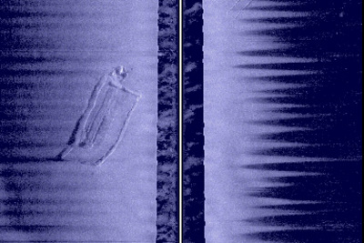
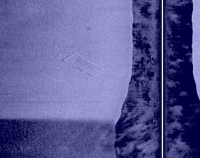
Actually, it reveals the flooded foundations of two buildings that existed before Wissota was filled in 1917.
There’s plenty of lore about a Wissota silo that is visible from the air, old roadbeds, and such. To date, I’ve found a railroad and the bed on which it was built, something that I’m pretty sure is a set of old bridge pilings from that now long-gone railroad, and now a couple of old stone foundations.
With a tip from Dave Markquart, I was able to collect some reasonable side images of these foundations. These are reasonable….not great….because the larger of the two foundations was imaged while motoring perpendicular to a 20-30 mph crosswind, causing my boat to roll side-to-side as I moved from trough, to crest, to trough, to crest. It is that rocking of the boat that gives the first of these two images its “sawtooth” appearance on the edges.
The second of the two foundations is much nicer…I imaged that foundation moving directly downwind, in the same direction of the waves. You can also see that foundation in the right hand side image of the first picture, towards the top of the frame.
These foundations are in 17 feet of water. I plan to go back and do a more complete survey of this area during my next trip on a reasonably calm day….whenever that happens!


