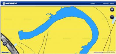
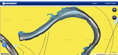
Navionics has the feature called Sonar Charts available on select sonars, create your own lake map and or improve your present map quick and easy. remember that you are not giving up waypoints just improving mapping, lets say you log sonar improve the mapping and afterwords you are studying your lake map and you see a point, hump, breakline that you did not know existed before and you find fish on that piece of structure! Sounds like a bonus to me. Navionics SonarCharts also adjusts coastlines which is the only mapping company that will do that. Also SonarCharts is available NOW. You don’t have to do a grid pattern and multiple users can contribute vs a single boater trying to do it all.
http://www.navionics.com/en/navionics-plus
Here is a link to how easy it is to do…
http://www.navionics.com/sites/www.n…ogs_Upload.pdf
Compatibility chart
http://navionics.com/sites/www.navio…ityGuide_3.pdf
For right now Sonar Logging cant be done on Lowrance but you can with Humminbird, Ray Marine and Garmin
You can read Sonar Charts on Lowrance you just cant log sonar and upload to Navionics with Lowrance
Link to the Sonarcharts details http://www.navionics.com/en/sonarcharts


