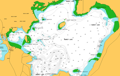
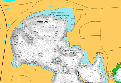
Does anyone have one of these? Navionics has not responded to my emails, and the boxes are marked non returnable once opened. I am looking for a screenshot of a lake that is a new HD addition this year. My chip from a few years ago was so far off for this lake on mid-lake structure I did not even use it after the first day. I did send in a report to them about it and the fact that half the lake was not even displayed. (showed it as land, is in fact 300+ft deep)
So, to avoid blowing $150 on a new map chip (not including the rebate on my old chip)I am wondering if someone with this chip could look it up and send me a screenshot or two from their units so I could get a look at it before/if I buy.
The lake I am interested in seeing is Rabbit, in Crow Wing county, MN it’s just north of Cuyuna and Crosby. I am interersted to see if they included the east basin this time and maybe a closer look at the point in the north end of the west basin, this point was off by several hundred feet on the chip I have now. Thought I would race off and drive right up to the point and drop a few buoy’s for the rest of the guys I was fishing with, came off plane on top of it and map showed me still a ways off from it! 
Good thing it was not shallow enough for me to hit!
Anyways, hope someone can help me out here, PM me if you want my email outside of the site here.
Thank you!!


