Pinch points are where the natural topography makes a deer take a certain route to still feel safe and secure. A great example of this is there is a small strip of woods bordered on both sides by open cover. The deer utilize the woods as cover versus walking in the open and being exposed.
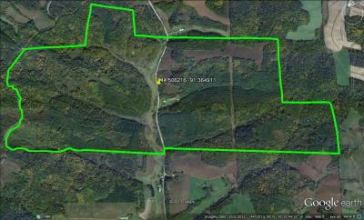
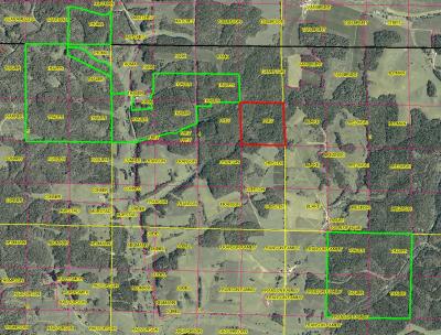
Google Earth is a great application for locating natural pinch points and travel corridors. If you want to post a screen shot of your hunting property, I would be more than happy to point out some spots that look promising to check out on foot. As good as the satellite imagery is though, you will still need to go and check the location out before deciding to hang a stand.
Bedding is a little tougher. Depending on the pressure, deer might use thicker or more open bedding areas. On the farm that I have hunted for almost 20 years, the deer use the really thick nasty stuff as their bedding area. Tree tops, downed trees and wild rose bushes make great bedding areas. In areas where the pressure is lower, deer will tend to bed where they can see or smell danger. Often these will be located on a hill, slightly below the crest. This prevents the deer from being silhouetted and allows them to survey the lower approach routes for danger.
Bedding areas are sometimes a little difficult to locate. However, if you know where they are feeding, you can find the trails that they come to the food source on. This will point you in the right direction as to where they are coming from. A word of caution though. If you go tromping into a bedding area now, you could potentially alter their patterns and it might make them less likely to move before dark. A useful tip is to hang a stand in a location where the deer are coming to the food. If after a couple of sits you notice the deer aren’t into the feeding areas before dark, then start to move into the woods more. Keep repeating this process until you start understand where the deer are spending the daylight hours. While this process takes more time and is more reactive than proactive, it lessens the chances that you will spook the deer permanently from where they are bedding.
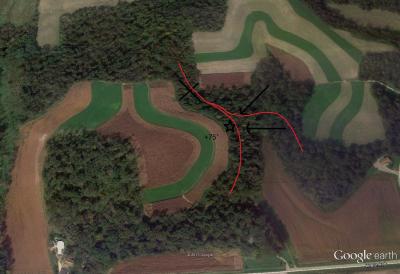
I have attached a screen shot of my favorite stand to hunt during the rut. This is a perfect example of when Google earth can be effective but also have it’s limits.
When I first hunted this area, I hung a stand where the X is located. It looked perfect as it was right on the main travel route between known bedding areas (red line) and would force the deer to funnel through the woods instead of walking in the open fields. However, I NEVER saw deer come through that funnel when in the tree, because the stand was in the bottom of a small depression and the wind always swirled there. After two years of hunting it, I nearly gave up on that part of the farm altogether. Instead, I moved the stand up the hill and away from the funnel to where the star is located. This helped with getting winded and it taught me a very valuable lesson. During the rut when bucks are on their feet a lot, they want to cover as much ground as possible looking for hot does. When the wind is out of the east or northeast, the bucks walk on the upper side of the hill to scent check for hot does. This forces them to walk down the main trail and within 20 yards of my stand. I have shot a mature buck under these conditions during the rut each of the last 3 seasons.
Sorry for the long winded post, but hopefully this helps!


