With this warm weather weekend coming up I figured a lot of folks will be heading to Bayport to ice fish the St Croix. One of the common questions asked on the forum is how to access the St Croix at Bayport. I was heading down to Bayport this afternoon so I grabbed my camera and I thought I would shoot a few photos of the access point to help with the written directions. Here goes:
On the south end of Bayport on Highway 95 you will see the entrance to 5th Avenue South on the east side of the road. There is a Bayport sign on a limestone rock and a large sign for Clyde’s. Here is the photo:

Turn east onto 5th Avenue South but don’t enter the marina but instead stay to the left and travel down 5th Avenue South to the T intersection with 3rd Street South. Here is the photo:
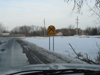
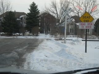
You will need to take a right turn on 3rd Street South and cross over the railroad tracks. Note the Dead End sign with the smaller “Road Open to River” sign under it. Here is the photo:
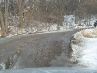
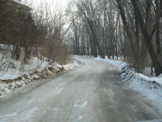
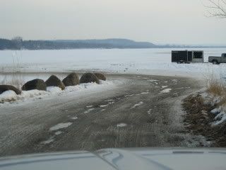
This road will take you to the St Croix River. Be Careful – it is a narrow, well rutted road that gets worse as the weather warms. This is the only road on the MN side of the river that gives drive on access to the river and it gets a lot of traffic. Go slow – watch for traffic and try to give as much room as possible to vehicles towing trailers and fish houses. Be advised – there is No Parking anywhere on the side of this road. If you want to pull off go all the way to the river and then drive out on the ice and pull off. Don’t stop on the road and try to park. Here are some photos of the road to the river:
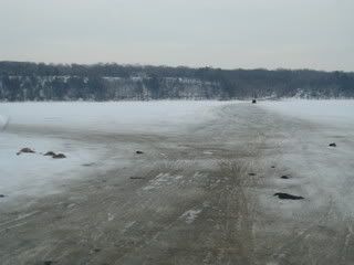
Once you get on the ice you will see a road heading directly across the river. That is the ice road to Ferry Landing in Hudson which is the St Croix access point from Hudson, Wisconsin. Here is the photo:
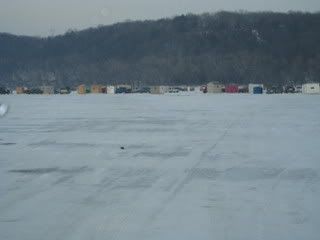
You will see another ice road turning to the left and heading north. This is the ice road to ShantyTown and up river to the High Lines across from the Excel Energy Allen S. King Plant. Here is the Photo of ShantyTown:
If you plan on heading north of ShantyTown up to the High Lines you want to stay on the Wisconsin side of the river. Be advised that there is open water directly across from the Excel Energy Plant from their warm water discharge. Stay to the Wisconsin shore on the ice road and you are OK. If you do not pay attention and just start driving north you could find yourself driving right into open water. Be Careful. My advice is to scout during the day and familarize yourself with the area before trying to drive north to the High Lines at night or in the fog during warm weather days.
One other thing for those not familiar with Andersen Bay. This year Andersens Windows has a warm water discharge into the north end of the bay. That has created open water and thin ice in the north end of the bay. I used to fish up in there and so did other people. This year there is thin ice and it is dangerous up in the bay. The ice is precarious from about the Andersen Boat Launch access point all the way up into the north end. Andersen’s also has a bubbler going under their boat dock and this is also keeping the ice thin. Be careful if you go up into the north 1/3 of the bay.
Should be a good weekend for ice fishing and I expect a lot of traffic on the St Croix. Read some of the fishing reports especially those by Turk. My experience is on a very busy day it pays to get away from the crowds. It gets crazy out there with cars, trucks, ATVs, snowmobiles, and even the occasional airplane. Good luck – Be safe.
 now everybody is going to know


