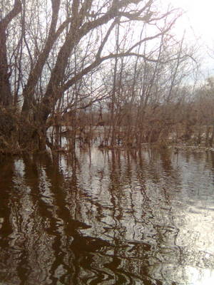
Nothing spectacular yet, but she’s got a few days before she crests. Some nice timber flowing down the river. As I was turning down the road, someone in with a RiverPro was leaving. Not sure if they turned back or took it for a spin.
IDO » Forums » Fishing Forums » Fishing by Species » Catfish & Sturgeon » Lyndale Launch Rising Water Picts
Nothing spectacular yet, but she’s got a few days before she crests. Some nice timber flowing down the river. As I was turning down the road, someone in with a RiverPro was leaving. Not sure if they turned back or took it for a spin.
Darn Mike….. I must have missed you by a short bit….
The water was coming up quick. Earlier in the day the city of Bloomington was on the launch and Excel Energy were on the other side, doing some survey work.
I heard that the RP you spotted did well on trial runs today after some extensive work. 
Quote:
How was the current? Pretty fast? It looks like if you casted from the bank you’d still be in pretty shallow water.

The current is deceptively fast. You can tell by the water boiling behind the pilings and by the large trees flying down that it is cruising. On the upstream part of the bridge close to shore it is relatively deep. Normally I fish at the bottom of a steep bank where the waters edge is and I cannot see over the bank, so it drops into 6+ foot of water right from what is now the shorline. I would guess where I was standing will be covered with a few inches of water when it crests.
Quote:
Darn Mike….. I must have missed you by a short bit….
The water was coming up quick. Earlier in the day the city of Bloomington was on the launch and Excel Energy were on the other side, doing some survey work.I heard that the RP you spotted did well on trial runs today after some extensive work.

The beginnings of the wash out I filmed I bet will eventually wash away part of that road the city uses when all is said and done. I guess it is not in the video I linked to, but you can see it on my YouTube page.
Quote:
Did you upload the video to Youtube from the Droid?
Originally I did, but then I replaced them by copying from the Droid to my PC and then uploaded it. I wanted to see if it would compress it less and have better quality, but in the end I don’t think there was a difference. I am going to try live streaming some trips this year using Qik (Qik.com/mplspug).
Thanks for the pics. I was wondering how high the water was down there. Looks like it’s up there!
If she keeps going up as predicted. IT will cover the launch roundabout and lower part of the parking lot.
As for speed of the current. Its hauling right now.
If you look at the charts it close to 3-4 X faster than normal. My best guess would be a current of at least 6 mph it might be up in 7-10 MPH…
http://waterdata.usgs.gov/mn/nwis/uv?cb_00060=on&cb_00065=on&cb_00011=on&cb_00055=on&cb_00045=on&format=gif_default&period=7&site_no=05330920
I’ve been in some rough seas in my old Navy Days…. I have to admit in looking at the river yesterday, I could be a little intimidated if faced with having to put a boat on it.
Nice video and pics Pug. 
I have to ask though, are you using a Pink fishing rod in one of the pictures? I can not quite make out what it is, but it is pink and looks like a fishing rod lol! 
Keep us updated dude!
I didn’t notice that until I got home. It is a ribbon hanging from the tree or something. I made about 3 casts with a Rapala Rattle Trap and got snagged because I was dicking around. I should have brought jigs instead. I was hoping maybe to find a school of white bass pinned against the shore.
I wonder if the backwater downstream on that side has fish in it now getting out of the current. Hmmm….
That Pink ribbon was probably a visual for when they were doing surveying earlier in the day.
I know lol, just having some fun with downtown pug. 
I figured it was just some trash. Good thought Larry.
Sorry Pug. I went to rate your video 5 stars on the Tube and my mouse ventured on to the 4 stars.  I hate how sensitive those rating stars are. We need about 5-10 guys to submit 5 star rating now.
Edit: Nope, I was able to browser back and submit again! 
That’s ok. I don’t tether my ego to my stars.  Has anyone revisited the clonking video yet?
Looks like I will need galoshes to get picts on the road again for comparison.
Quote:
Looks like I will need galoshes to get picts on the road again for comparison.
You might need your hip boots… its slated to go up another 6-8ft according to Noaa.
Quote:
You might need your hip boots… its slated to go up another 6-8ft according to Noaa.
I don’t know exaclty how the dynamics work, but I can’t imagine it getting that high in that area because once it is over the bank, the surface area in the least doubles, at least in that immediate area. But 6-8′ in that area would certainly be a site to see.
Another area of the flood plain I would like to see is down by the bass ponds/Hogback Ridge.
Pug,
I’ve wondered the same thing, its interesting to look at the data from CFS to velocity during the normal times and what it’s doing now.
A couple things to keep in mind.
NOAA is usually pretty aggressive in its predictions.
This is based for Savage though a short way up stream, does not have as much of the low spread out area like there is by the lyndale launch.
I’ll be curious to see how far up this goes.
I heard that they closed 101 in Shakopee.
http://www.crh.noaa.gov/ahps2/hydrograph.php?wfo=mpx&gage=savm5&view=1,1,1,1,1,1,1,1&toggles=10,7,8,2,9,15,6&type=0
Shoot. They say Eagle Creek starts backing up too. I bet you could at least catch some roughfish in there when it does, but that doesn’t matter if they close the road and you can’t reach it. So is Blackdog Rd under water then? I assume it was closed as early as Thursday when I was filmong, because there was quite a few vehicles by the bridge parked. My guess is they were sightseeing, but could not go any further because it was closed off.
So we all might have to take time and go rescue any flats and channels that get stranded in little pothole areas when the waters finally recede, eh?
More pixs as of this morning at 9:00am.
This afternoon they closed lyndale accessing the landing. Looking to the north where US Salt is the river appears to be just a foot or so from going over that bank
Scott


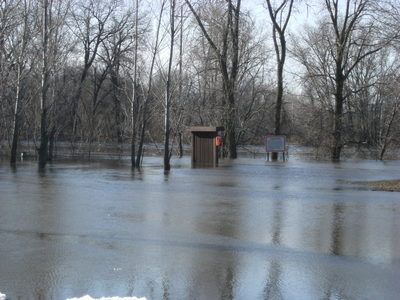
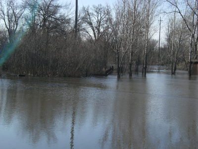
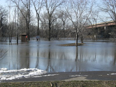
Well if you find them, they should be piled up. I am hitting a spot where last year I had fast action at the height the river is at. Last year when I went back to the spot about a week after I was on them and the water was down 2-3 feet and it was dead. If you find them, hit’em hard, because once the water starts going down they move.
if you fellas could hold that water back a little bit i’d appreciate it. Its killing my  my fishing down here in the hawkeye state!


I was going to take pictures today on the way to Fleet Farm, but the road is closed. Coming back, I saw it looked like at least 2/3 of the parking lot is under water, or 80% if you include the launch part.
Has anybody checked on the Lilydale landing? The road was still “closed” by the park, therefore we turned the rig around and checked the 494 ramp, which was still under water and full of mud/debris. I was hoping to get on the river this week…doesnt look like that is going to happen!
It might be a late season for MN river access…. depending on how bad the launches got mudded over. In years past they set memorial day as the day to have the launches operational..

Lets hope the water drops quick, we may have to start putting calls into the city and DNR to get things rolling.
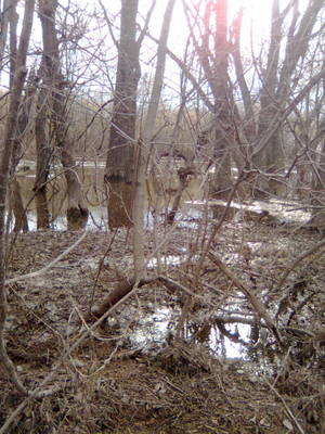
I was down at my creek just up river. Uall know were I was at if U know me the (brown smoker craft)fished till 12:00 am 1 run no fish. seen 1 guy out there on his boat NOT ME . The river is under the bank about a 1/2′ and there is a lot of fire wood agine. When is the contest I sean that guy out there on that river pro that is 1 kool boat he was going right over BIG ice sheets bigger that the boat the pix are from 4-10-10
You must be logged in to reply to this topic.