well I’d best keep out of this and keep those “rubble spots” at the second break a secret! There’s only bullheads there anyways!
Okay, I will not dispute. I have floated my boat all along that north shore and have seen little if any “first break is rocks to sand, second break would have some rocks mixed with the sand”?
Mostly all sand from the shoreline out from Malmo to past Wealthwood and all along the infamous north shore beaches. There is an isolated rock pile east of Red Door worth checking out.
<div class=”d4p-bbt-quote-title”>crappieguy wrote:</div>
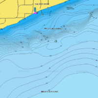
Around this time every year Red Door always talks about fishing picking up off the second break in their fishing report and I’ve never been able to decipher it. Once their ice road gets going people always ask if they are out past the second break yet as well…
It’s right where I said it was. I just got back from Red Door – they have their houses on the 2nd break.
Break refers to Breakline – which is depth change, not bottom composition.
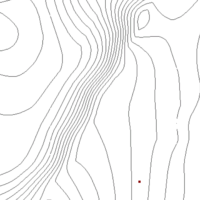
I can see it on the topo map. That would be an area that would be bypassed open water, as the first sand break would be the muskie/pike trolling milk run and then everyone else would be running to the flats for walleye.
I have only fished that area open water. I’ll find out more as you say. Just got back from fishing the east side and will turnaround and go back out of Red Door Friday through the weekend with a couple grandsons participating in fund raising event. Hoping the grandsons will see a Mille Lacs walleye. 

