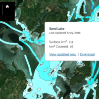
So I have been collecting data on various lake, both local as well as up north. It is easy to see the Lowrance Map and Navionics maps are inaccurate many of the times. I am only a Genesis Social (free) member and not a paying Genesis Edge member. When I get back from a trip, I upload vairous files to the website and wait for it to indicate that the data now appears in Social Maps. However, when I look at the Social Maps, the uploaded data is not indicate whatsoever. I know it is not an issue that the data is the same as the current data on Social Maps because I am mapping in an areas where there is no data or collecting data on a lake that has no data at all.
Has anyone else experienced this? Am I doing something incorrect? Any help is appreciated.
Cory
