C-Map Genesis

  • Kyle Wills
    Posts: 217
    #1776596

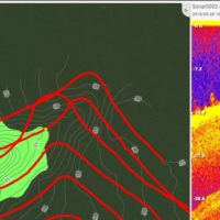
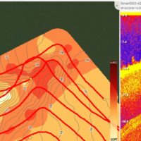
    Anyone else using C-Map Genesis to map lakes? I just started this past weekend on a local lake. Wow, I really like it. Having the ability to know where the weed line is, along with bottom contours is a game changer. Something I really like is the ability to go back and look at your track and see what the sonar unit shows.

    I have about half the lake done and just in going back and looking at my tracks and looking at weed lines and bottom hardness I know where to focus my time.
    Attachments:
    1. CMapGen.jpg

    2. CMapGen2.jpg

    Chris Messerschmidt
    Minnesota
    Posts: 615
    #1776664

    So I have used it in the past, but stopped using it. The weed lines are nice, but those are always changing so it was hard to rely on it.

    The bottom composition is really nice if you want to fish mud to rock or any other type of transition. But I have gotten used to using Structure Scan overlay and waypoints.

    I can mark a weed line and a transition line and such.

    Kyle Wills
    Posts: 217
    #1776826

    @Chris I agree, weed lines are always changing and I would say that’s the least used part of it. The bottom comp is what I like most. I think where this application can really help is during ice fishing. I can mark waypoints in CMap and export them to a GPX file for my GPS for focusing on these transition areas.

    Contours in general are always nice, because there are a lot of inaccurate maps out there. This lake was one of them. Navionics map did not show longer shoreline points on this lake. Another plus is I can choose to share or not share the contours if I want, in order to keep some spots a bit more secret if I want.

Viewing 3 posts - 1 through 3 (of 3 total)

You must be logged in to reply to this topic.